Taum Sauk Mountain State Park
| Taum Sauk Mountain State Park | |
| Missouri State Park | |
 | |
| Country | United States |
|---|---|
| State | Missouri |
| Counties | Iron, Reynolds |
| Elevation | 1,772 ft (540 m) [1] |
| Coordinates | 37°34′17″N 90°43′45″W / 37.57139°N 90.72917°WCoordinates: 37°34′17″N 90°43′45″W / 37.57139°N 90.72917°W [1] |
| Area | 7,500 acres (3,035 ha) [2] |
| Established | 1991 [3] |
| Management | Missouri Department of Natural Resources |
| Visitation | 90,743 (2014) [4] |
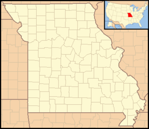  Location in Missouri | |
| Website: Taum Sauk Mountain State Park | |
 |
Wikimedia Commons has media related to Taum Sauk Mountain State Park. |
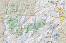
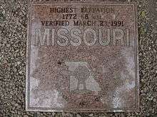
Taum Sauk Mountain State Park is a Missouri state park located in the Saint Francois Mountains in the Ozarks. The park encompasses Taum Sauk Mountain, the highest point in the state.[2] The Taum Sauk portion of the Ozark Trail connects the park with nearby Johnson's Shut-ins State Park[5] and the Bell Mountain Wilderness Area, which together are part of a large wilderness area popular with hikers and backpackers.
Activities and amenities
The park has a rustic campground, a paved trail to the highpoint, picnic facilities, and a lookout tower from which a good view can be had; the dense forest on the mountain obscures the view from most other vantage points.
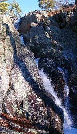
Mina Sauk Falls, the highest waterfall in Missouri,[6] is on Taum Sauk and can be visited by hiking a rugged trail that makes a three-mile (5 km) loop from the highpoint parking area.[7] The falls have cascading waters only during times of wet weather; at other times they are reduced to a trickle or less.
References
- 1 2 "Taum Sauk Mountain". Geographic Names Information System. United States Geological Survey.
- 1 2 "Taum Sauk Mountain State Park". Missouri State Parks. Missouri Department of Natural Resources. Retrieved September 8, 2014.
- ↑ "State Park Land Acquisition Summary". Missouri State Parks. Retrieved August 14, 2015.
- ↑ "Missouri State Park Attendance (2014)" (PDF). Missouri State Parks. 2015. Retrieved August 14, 2015.
- ↑ "Taum Sauk Section". The Ozark Trail. Ozark Trail Association. Retrieved September 8, 2014.
- ↑ "St. Francois Mountains". Missouri Department of Conservation. Conservation Commission of Missouri. Retrieved September 8, 2014.
- ↑ "Park Trails at Taum Sauk Mountain State Park". Missouri State Parks. Missouri Department of Natural Resources. Retrieved September 8, 2014.