Teeswater River
| Teeswater River | |
| River | |
| Name origin: Named after the River Tees in England | |
| Country | Canada |
|---|---|
| Province | Ontario |
| Region | Southwestern Ontario |
| County | Bruce |
| Municipalities | Arran–Elderslie, Brockton, South Bruce |
| Part of | Great Lakes Basin |
| Source | |
| - location | Bruce County |
| - elevation | 377 m (1,237 ft) |
| - coordinates | 43°58′28″N 81°05′46″W / 43.97444°N 81.09611°W |
| Mouth | Saugeen River |
| - location | Arran–Elderslie |
| - elevation | 214 m (702 ft) |
| - coordinates | 44°18′24″N 81°16′23″W / 44.30667°N 81.27306°WCoordinates: 44°18′24″N 81°16′23″W / 44.30667°N 81.27306°W |
| Length | 75 km (47 mi) |
| Basin | 683 km2 (264 sq mi) |
| Discharge | |
| - average | 11 m3/s (388 cu ft/s) |
| - min | 0.63 m3/s (22 cu ft/s) |
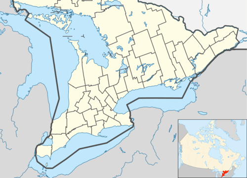  Location of the mouth of the Teeswater River in southern Ontario | |
The Teeswater River is a river in the municipalities of Arran–Elderslie, Brockton and South Bruce in Bruce County in Southwestern Ontario, Canada.[1][2] It is in the Great Lakes Basin and empties into the Saugeen River at Paisley, Ontario.[3]
The community of Teeswater is located on the river.
The river was named after the River Tees in England.
References
- ↑ "Teeswater River". Geographical Names Data Base. Natural Resources Canada. Retrieved 2012-10-18.
- ↑ "Teeswater River". Atlas of Canada. Natural Resources Canada. 2010-02-04. Retrieved 2012-10-18. Shows the course of the river highlighted on a topographic map.
- ↑ "Teeswater River Watershed Report Card" (PDF). Saugeen Conservation. 2008. Retrieved 2012-10-18.
Other map sources:
- Map 4 (PDF) (Map). 1 : 700,000. Official road map of Ontario. Ministry of Transportation of Ontario. 2012-01-01. Retrieved 2012-10-18.
- Restructured municipalities - Ontario map #6 (Map). Restructuring Maps of Ontario. Ontario Ministry of Municipal Affairs and Housing. 2006. Retrieved 2012-10-18.
See also
This article is issued from Wikipedia - version of the 3/19/2016. The text is available under the Creative Commons Attribution/Share Alike but additional terms may apply for the media files.