Pic de Tenneverge
| Pic de Tenneverge | |
|---|---|
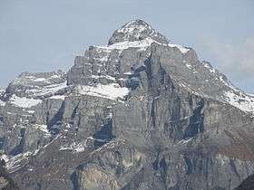 View from Sixt-Fer-à-Cheval (west side) | |
| Highest point | |
| Elevation | 2,985 m (9,793 ft) |
| Prominence | 201 m (659 ft) [1] |
| Isolation | 3.6 km (2.2 mi) [2] |
| Parent peak | Tour Sallière |
| Coordinates | 46°05′39″N 06°52′42″E / 46.09417°N 6.87833°ECoordinates: 46°05′39″N 06°52′42″E / 46.09417°N 6.87833°E |
| Geography | |
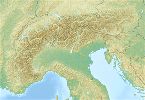  Pic de Tenneverge Location in the Alps | |
| Location |
Haute-Savoie, France (mountain partially in Switzerland) |
| Parent range | Chablais Alps |
Pic de Tenneverge is a mountain of the Chablais Alps, located between the French department of Haute-Savoie and the Swiss canton of Valais. Its summit is 2,985 metre-high and lies within France, 300 metres west of the border with Switzerland (2,951 m). The mountain is located between Sixt-Fer-à-Cheval (France) and Lac d'Emosson (Switzerland).
References
External links
 Media related to Teneverge at Wikimedia Commons
Template:Haute-Savoie-geo-stub
This article is issued from Wikipedia - version of the 12/6/2015. The text is available under the Creative Commons Attribution/Share Alike but additional terms may apply for the media files.