Texas State Highway 222
| ||||||||||
|---|---|---|---|---|---|---|---|---|---|---|
 | ||||||||||
| Route information | ||||||||||
| Maintained by TxDOT | ||||||||||
| Length: | 59.929 mi[1] (96.446 km) | |||||||||
| Existed: | by 1936[2] – present | |||||||||
| Major junctions | ||||||||||
| West end: |
  US 82 / SH 114 US 82 / SH 114 | |||||||||
 US 277 US 277 | ||||||||||
| East end: |
 US 380 west of Throckmorton US 380 west of Throckmorton | |||||||||
| Highway system | ||||||||||
| ||||||||||


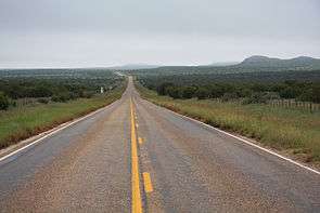
Texas State Highway 222, north of Buzzard Peak, King County, Texas.
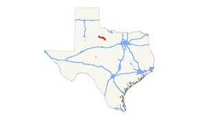
State Highway 222 or SH 222 is a state highway that runs 60 miles (97 km) through portions of north central Texas. The route was originally designated by 1928[3] between Knox City and Munday as SH 126, but was renumbered to SH 222 by 1936,[2] and extended due north to US 82, replacing SH 252.[4] The section north of Munday was transferred to FM 267 in 1948. In 1990, the route was extended to about five times its previous length, when sections were added from FM 143, FM 1587, FM 266, and FM 1720.
Junction list
| County | Location | mi | km | Destinations | Notes |
|---|---|---|---|---|---|
| King | | US 82 / SH 114 | |||
| Knox | |  FM 2279 FM 2279 | |||
| |  FM 1292 FM 1292 | ||||
| Knox City |  SH 6 SH 6 | ||||
 FM 2701 FM 2701 | |||||
| |  FM 2365 FM 2365 | ||||
| |  FM 1043 FM 1043 | ||||
| | FM 1043 | ||||
| |  FM 267 FM 267 | ||||
| Munday |  FM 2811 FM 2811 | ||||
| US 277 | |||||
| Haskell | |  FM 266 FM 266 | |||
| |  FM 1720 FM 1720 | ||||
| Throckmorton | | US 380 | |||
| 1.000 mi = 1.609 km; 1.000 km = 0.621 mi | |||||
References
- ↑ Transportation Planning and Programming Division (n.d.). "State Highway No. 222". Highway Designation Files. Texas Department of Transportation. Retrieved 2010-06-22.
- 1 2 Official Map of the Highway System of Texas (Map). State Highway Commission (Texas Department of Transportation). 1936.
- ↑ Official Map of the Highway System of Texas (Map). Texas State Highway Department (Texas Department of Transportation). 1928.
- ↑
This article is issued from Wikipedia - version of the 7/30/2016. The text is available under the Creative Commons Attribution/Share Alike but additional terms may apply for the media files.