Melmoth, KwaZulu-Natal
| Melmoth | |
|---|---|
|
View from the north | |
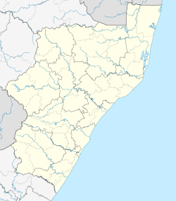  Melmoth  Melmoth  Melmoth
| |
| Coordinates: 28°35′S 31°23′E / 28.583°S 31.383°ECoordinates: 28°35′S 31°23′E / 28.583°S 31.383°E | |
| Country | South Africa |
| Province | KwaZulu-Natal |
| District | Uthungulu |
| Municipality | Mthonjaneni |
| Established | 1888 |
| Area[1] | |
| • Total | 13.36 km2 (5.16 sq mi) |
| Elevation | 740 m (2,430 ft) |
| Population (2011)[1] | |
| • Total | 7,814 |
| • Density | 580/km2 (1,500/sq mi) |
| Racial makeup (2011)[1] | |
| • Black African | 95.0% |
| • Coloured | 1.4% |
| • Indian/Asian | 0.8% |
| • White | 2.6% |
| • Other | 0.1% |
| First languages (2011)[1] | |
| • Zulu | 87.5% |
| • English | 4.5% |
| • S. Ndebele | 2.7% |
| • Afrikaans | 2.3% |
| • Other | 3.1% |
| Postal code (street) | 3835 |
| PO box | 3835 |
| Area code | 035 |
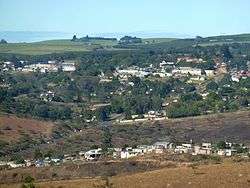
Melmoth is a small town situated in KwaZulu-Natal, South Africa. The town was established in the Mthonjaneni district after the annexation of Zululand by the United Kingdom in 1887 and was named after Sir Melmoth Osborn.[2] Large wattle plantations were set up and a wattle bark factory was established in 1926. The district is also planted with sugar cane from the outskirts of the town and into the surrounding villages. The government-funded hospital in Melmoth is St Marys kwaMagwaza Hospital that caters for the people of Melmoth and surrounding villages.[3]
The main road to Piet Retief is extremely busy during holiday periods.
Vehicle registrations in Melmoth start with NO - N for Natal, O for Osborn.[4]
Notable Residents
Shaka Zulu was born near modern-day Melmoth.
References
- 1 2 3 4 "Main Place Melmoth". Census 2011.
- ↑ "Gateway to Zululand". www.melmoth.co.za. Retrieved 2015-08-31.
- ↑ "KwaMagwaza Hospital". www.kznhealth.gov.za. Retrieved 2015-08-31.
- ↑ "Melmoth Information | Tourism Guide". www.wheretostay.co.za. Retrieved 2015-08-31.
Municipalities and communities of King Cetshwayo District Municipality, KwaZulu-Natal | ||
|---|---|---|
District seat: Richards Bay | ||
| uMhlathuze | .svg.png) | |
| uMlalazi | ||
| Nkandla | ||
| Mbonambi | ||
| Ntambanana | ||
| Mthonjaneni | ||