Topographia Galliae
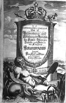
Engraved title page of first volume, Topographia Galliae, 1655
Topographia Galliae (1655-1661) is a German-language series of illustrated books created by engraver Matthäus Merian and writer Martin Zeiler, and published in Frankfurt. It describes cities and towns in 17th-century France.[1][2] Wenceslaus Hollar also contributed engravings.[3]
Volumes
- Topographia Galliae (in German and Latin) (1st ed.), Frankfurt: Caspar Merian, 1655- Check date values in:
|date=(help) (13 volumes)[4]- Topographia Galliae. 1. 1655 – via Bayerische Staatsbibliothek.; via Google Books
- Contents: Paris, Île-de-France; index
- Die fürnehmste und bekantiste Stätte und Plätze in der Provinc Picardiae. 2. 1656.
- Topographia Galliae. 1. 1655 – via Bayerische Staatsbibliothek.; via Google Books
- Topographia Galliae (in German) (2nd ed.). Frankfurt: Caspar Merian. 1655–1661 – via Rhineland-Palatinate Dilibri.
- Die fürnehmste und bekandiste Stätte und Plätze in der Provinc Champagne und Brie. 3. 1656.
- Die fürnehmste vnd bekantiste Stätte vnd Plätze von Burgund Bresse. Nivernois vnd Dombes. 4. 1656.
- Die fürnehmste vnd bekantiste Stätte vnd Plätze in den Ländern. Lyonnois. Forests. Beaviolois, vnd Bovrbonnois. 5. 1657.
- Contents: Lyon
- Die fürnehmste vnd bekantiste Stätte, vndt Plätze in den Ländern. Berry, Avergne. vnd Limosin. 6. 1657.
- Die fürnehmste vnd bekantiste Stätte vnd Plätze in der Provinc Beavsse, Chartrain. l Angov le Maine. le Perche. Vandosme. le Blaisois. Dvnois. la Tovraine. l'Orleanois. Poictov. l'Avnis. vnd l'Angovmois, Abhandlent. 7. 1657.
- Die fürnehmste vnd bekantiste Stätte vnd Plätze in dem Hertzogthumb Normandie. 8. 1657.
- Der Oerter Beschreibung in dem Hochlöblichen Königreich Franckreich/ Der Neundte Theil. Darinn Von dem Hertzogthum Bretaigne, oder dem Kleinern Britannien, in Franckreich gelegen. 9. 1661.
- Die fürnehmste und bekannteste Städte und Plätze in Guienne, Guascoigne, Saintonge, Bearn, und andern herumbligenden/ als/ Perigord, l'Agenois, &c. 10. 1661.
- Die fürnehmste und bekanteste Stätte und Plätze in Languedoc, Albigeois, Foix, Giuaudan, Lauraguez, Velay, Vivarez, Quercy, und Roüergue. 11. 1661.
- Contents: Montpelier, Toulouse, etc.
- Die Provantz, oder la Provence, sambt der anstossenden Graffschafft Venaiscin, Venissy, oder d'Avignon, und das Fürstenthumb von Oranges. 12. 1661.
- Contents: Avignon, etc.
- Das Land Dauphiné, oder das Delphinat. 13. 1661.
- Contents: Grenoble, etc.
See also
References
- ↑ Universal Cyclopaedia. 8. D. Appleton & Co. 1909.
- ↑ Jacques Charles Brunet (1844), "Histoire de France (23133)", Manuel du libraire et de l'amateur de livres [Catalogue for Booksellers and Bibliophiles] (in French), 5 (4th ed.), Paris: Firmin Didot frères
- ↑ Catalogue of Rare and Valuable Books on the Fine Arts (279), Bernard Quaritch, 1909,
Zeilleri Topographia Galliae
- ↑ Johann Georg Theodor Grässe (1867). Trésor de livres rares et précieux [Treasury of rare and valuable books] (in French). 6. Dresden.
Further reading
- Topographia Galliae. Amsterdam: Joost Broersz and Caspart Mérian, 1660.
External links
 |
Wikimedia Commons has media related to Topographia Galliae. |
This article is issued from Wikipedia - version of the 7/8/2016. The text is available under the Creative Commons Attribution/Share Alike but additional terms may apply for the media files.