Tremont Row
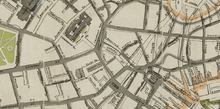
Detail of map of Boston in 1895, showing Tremont Row
Tremont Row (1830s-1920s) in Boston, Massachusetts, was a short street that flourished in the 19th and early-20th centuries. It was located near the intersection of Court, Tremont, and Cambridge streets, in today's Government Center area.[1] It existed until the 1920s, when it became known as Scollay Square.[2] In 1859 the Barre Gazette newspaper described Tremont Row as "the great Dry Goods Street of Boston."[3]
Tenants
|
|
new york dental parlors |
Images
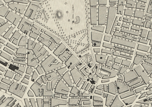 Detail of map of Boston in 1838, showing Tremont Row.
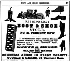 Advertisement for Tuttle & Oakes boots and shoes, 1848
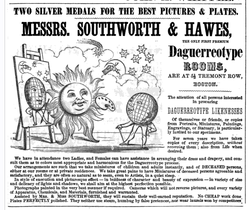 Advertisement for Southworth & Hawes, daguerreotypists, 1848
 Brattle Street, looking up towards Tremont Row, ca.1860s (Bostonian Society)
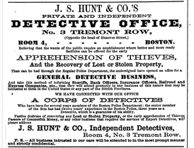 Advertisement for J.S. Hunt & Co. detective office, 1868
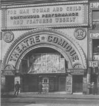 Theatre Comique, Tremont Row, Boston, ca.1916
See also
References
- ↑ Boston Street Laying-Out Dept. A record of the streets, alleys, places, etc. in the city of Boston. Boston: City Printing Dept., 1910
- ↑ "Tremont Row now Scollay Sq.: eleventh name in its history." Boston Globe, Feb. 20, 1926
- ↑ Barre Gazette (Barre, Mass.), May 27, 1859
- ↑ "Portrait of Gov. Briggs." Daily Atlas, Feb. 3, 1844
- 1 2 3 4 5 6 American Broadsides and Ephemera, Series 1
- ↑ Farmer's Cabinet (Amherst NH), Aug. 5, 1857
- ↑ The Boston Directory, 1895, page 420
- ↑ The Boston Directory, 1897, page 449
- ↑ Boston Directory, 1840
- ↑ The Crayon, Vol. 5, No. 4 (Apr., 1858)
- ↑ Daily Atlas, April 24, 1843
- ↑ Salem Gazette, March 16, 1841
- ↑ Daily Atlas, Jan. 1, 1845
- ↑ Barre Gazette (Barre, Mass.), Nov. 18, 1853
- ↑ "The paintings in Tremont Row." Daily Atlas, June 2, 1852
- ↑ "Chinese Azalia." Boston Daily Atlas, April 23, 1844
- ↑ "The Raven in the Frog Pond: Edgar Allan Poe and the City of Boston, an exhibition at the Boston Public Library, December 17, 2009 - March 31, 2010". 2009. Retrieved 2 April 2012.
Further reading
- "Tremont Row". Boston Register and Business Directory. Sampson & Murdock Co. 1914 – via HathiTrust.
- "Tremont Row". Boston Register and Business Directory. Sampson & Murdock. 1918 – via Google Books.
- "Tremont Row". Boston Register and Business Directory. Sampson & Murdock Co. 1921.
External links
 |
Wikimedia Commons has media related to Tremont Row. |
- Bostonian Society. Photos:
- Library of Congress:


Coordinates: 42°21′37.32″N 71°3′39.32″W / 42.3603667°N 71.0609222°W
This article is issued from Wikipedia - version of the 11/21/2016. The text is available under the Creative Commons Attribution/Share Alike but additional terms may apply for the media files.