Trihi, South Australia
| Trihi South Australia | |||||||||||||
|---|---|---|---|---|---|---|---|---|---|---|---|---|---|
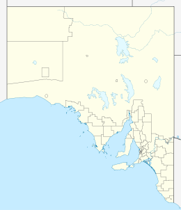  Trihi | |||||||||||||
| Coordinates | 37°30′S 140°36′E / 37.500°S 140.600°ECoordinates: 37°30′S 140°36′E / 37.500°S 140.600°E | ||||||||||||
| Postcode(s) | 5279 | ||||||||||||
| Time zone | ACST (UTC+9:30) | ||||||||||||
| • Summer (DST) | ACDT (UTC+10:30) | ||||||||||||
| Location | 25 km (16 mi) NE of Millicent | ||||||||||||
| LGA(s) | Wattle Range Council | ||||||||||||
| State electorate(s) | MacKillop, Mount Gambier | ||||||||||||
| Federal Division(s) | Barker | ||||||||||||
| |||||||||||||
Trihi (postcode 5279) is a former locality in the south east of South Australia. It was named after Trihi Lagoon. It was assigned a locality name under the Geographical Names Act in 1997 with revised boundaries in 2001.[1][2] It was abolished on 26 November 2015 and the land within divided between Kalangadoo and Mount McIntyre.[3][4]
References
- ↑ "Placename Details: Trihi". Property Location Browser. Land Services Group, Department of Planning, Transport and Infrastructure, Government of South Australia. 27 February 2008. SA0053171. Retrieved 20 February 2015.
- ↑ "GEOGRAPHICAL NAMES ACT 1991" (PDF). South Australian Government Gazette. J. D. FERGUSON, Government Printer, South Australia. 13 December 2001. p. 5365. Retrieved 20 February 2015.
- ↑ "Notice to Discontinue the Name and Boundary of a Place and to Alter the Boundaries of Places" (PDF). Government of South Australia. Retrieved 26 March 2016.
- ↑ "Proposed Boundary Map" (PDF). Government of South Australia. Retrieved 26 March 2016.
This article is issued from Wikipedia - version of the 5/8/2016. The text is available under the Creative Commons Attribution/Share Alike but additional terms may apply for the media files.