Tsama Pueblo
|
Tsama Pueblo | |
|
Tsama bowl, an example of Rio Grande White Ware | |
   | |
| Nearest city | Abiquiu, New Mexico |
|---|---|
| Area | 24.3 acres (9.8 ha) |
| NRHP Reference # | 83004158[1] |
| Added to NRHP | November 17, 1983 |
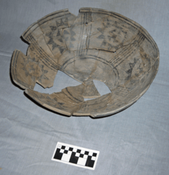
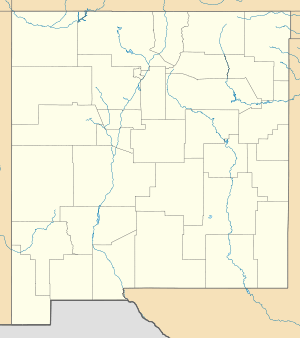
The Tsama Pueblo is a Tewa Pueblo ancestral site in an address-restricted area of Abiquiú, New Mexico. It was occupied from around 1250 until around 1500 and contained 1100 rooms.[2] The site and others in the area were explored by Florence Hawley Ellis in the 1960s and 1970s.[3] In 1983, it was listed on the National Register of Historic Places listings in Rio Arriba County, New Mexico.[4] Tsama is located 3 miles (4.8 km) from the Poshuouinge site.[5] The Sapawe site is closely related.[6] In December 2008, The Archaeological Conservancy extended the Tsama Archaeological Preserve by 11.6523 acres, mostly cobble mulch garden plots which were likely once constructed by the residents of Tsama Pueblo.[7]
References
- ↑ National Park Service (2010-07-09). "National Register Information System". National Register of Historic Places. National Park Service.
- ↑ Killion, Thomas W. (1992). Gardens of prehistory: the archaeology of settlement agriculture in Greater Mesoamerica. Society for American Archaeology. Meeting, University of Alabama Press. p. 56. ISBN 978-0-8173-0565-9. Retrieved 27 September 2011.
- ↑ Kass-Simon, Gabriele (February 1993). Women of science: righting the record. Indiana University Press. p. 24. ISBN 978-0-253-20813-2. Retrieved 27 September 2011.
- ↑ Capace, Nancy. Encyclopedia of New Mexico. North American Book Dist LLC. pp. 322–. ISBN 978-0-403-09607-7. Retrieved 27 September 2011.
- ↑ Koenig, Harriet (March 2005). Acculturation in the Navajo Eden: New Mexico, 1550-1750, Archaeology, Language, Religion of the Peoples of the Southwest. YBK Publishers, Inc. pp. 90–. ISBN 978-0-9764359-1-4. Retrieved 26 September 2011.
- ↑ Baker, Lee A.; Sundt, William M. (1990). Clues to the past: papers in honor of William M. Sundt. Archaeological Society of New Mexico. p. 89. Retrieved 27 September 2011.
- ↑ "The Archaeological Conservancy 2008 Annual Report" (PDF). Archaeological Conservancy. Retrieved 27 September 2011.
Coordinates: 36°11′43″N 106°12′52″W / 36.1953174°N 106.2145758°W
Municipalities and communities of Rio Arriba County, New Mexico, United States | ||
|---|---|---|
| City | 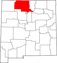 | |
| Village | ||
| CDPs |
| |
| Other unincorporated communities | ||
| Ghost towns and former settlements | ||
| Indian reservation | ||
| Footnotes | ‡This populated place also has portions in an adjacent county or counties | |
| Topics | |
|---|---|
| Lists by states |
|
| Lists by insular areas | |
| Lists by associated states | |
| Other areas | |
| |

