U.S. Route 287 in Texas
| ||||||||||
|---|---|---|---|---|---|---|---|---|---|---|
_map.svg.png) | ||||||||||
| Route information | ||||||||||
| Maintained by TxDOT | ||||||||||
| Length: | 503.898 mi[1] (810.945 km) | |||||||||
| Existed: | 1942 – present | |||||||||
| Major junctions | ||||||||||
| South end: |
   US 69 / US 96 / SH 87 in Port Arthur US 69 / US 96 / SH 87 in Port Arthur | |||||||||
|
    I-27 / I-40 / US 60 / US 87 in Amarillo I-27 / I-40 / US 60 / US 87 in Amarillo | ||||||||||
| North end: |
 US-287 near Kerrick US-287 near Kerrick | |||||||||
| Highway system | ||||||||||
| ||||||||||


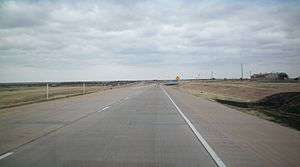
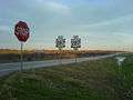
U.S. Highway 287 (US 287) in the U.S. state of Texas is a U.S. Highway that begins on the Gulf Coast in Port Arthur and heads north through Fort Worth, northwest to Childress, Clarendon, and Amarillo in the Texas Panhandle and into Oklahoma near Kerrick.
Route description
US 287 crosses into Texas at Kerrick and continues southeast through to Stratford, where it takes a more southerly turn. In Dumas, US 287 merges with its "parent route", US 87, and continues its south/southeasterly path as a co-signed route to Amarillo.
After passing through the heart of downtown Amarillo, US 87 splits off to the south to merge with I-27, and US 287 merges with I-40 and continues co-signed with the interstate until just west of Rick Husband Amarillo International Airport, where it veers to the southeast toward Claude, the seat of Armstrong County.
US 287 follows this east-southeasterly path through Clarendon and Childress, where it intersects US Highways 83 and 62. US 287 then proceeds to Vernon, where it merges with (and is briefly co-signed with) US 70 and US 183. After US 70 and US 183 leave the route at Oklaunion and veer to the northeast, US 287 resumes its east-southeasterly track passing through Harrold and Electra on its way to Wichita Falls. On the northwest side of the city US 287 merges with I-44, US 82, and (briefly) US 277. After leaving Wichita Falls, US 82/287 continues as a co-signed route until Henrietta, where US 82 leaves the route. After merging with US 81 in Bowie, US 287/81 continues southeast to Fort Worth, where it merges with I-35W on the north side of town. Just northwest of this interchange, Business US 287 veers off to the right following the original routing into Saginaw and into downtown Fort Worth while zig zagging its way through city streets to Kennedale and Mansfield before coming out onto the US 287 Freeway south of Interstate 20 near the Ellis County line just north of Midlothian.
Here, US 81 hits its terminus, but US 287 continues, concurrent route with I-35W through to the north end of downtown Fort Worth before splitting off to the southeast and once again picking up its own signage. This stretch of US 287, which runs from downtown to the southeast side of the city, is also known as the Martin Luther King, Jr. Freeway. In southeast Fort Worth, US 287 intersects with, and is briefly co-signed with, I-820 (which then dumps into I-20) before veering to the southeast yet again, where it passes through the extreme western side of Arlington, and then on in to Mansfield and Midlothian The freeway which previously terminated at the Tarrant/Johnson County line has been extended continuing on into Ellis County to connect with the existing freeway around Waxahachie, which includes a bypass around Midlothian and an interchange with US 67.
After intersecting with I-35E just north of Waxahachie, US 287 continues to the southeast, where it merges with I-45 just south of Ennis and follows the interstate to Corsicana where it then leaves the route and makes another sharp turn to the east. The highway continues southeastward to Palestine, where it merges with State Highway 19. US 287/SH 19 continues as a co-signed route until Crockett, where US 287 leaves SH 19 and continues its southeasterly track toward the Texas Gulf Coast.
In Woodville, US 287 merges with US 69 and takes on a more due-southerly route to Lumberton, where a co-signed US 69/287 also merges with US 96. The highway then continues to the southeast through Beaumont with a short stint with Interstate 10 and on to Port Arthur, where the route terminates at an intersection with State Highway 87.[2]
History
Before 1939, the portion from the Oklahoma state line to Amarillo was SH 9, from Amarillo to Henrietta was SH 5, Henrietta to Bowie was SH 50, Bowie to Fort Worth was SH 2 and US 81, Fort Worth to Ennis SH 34, Ennis to Corsicana was SH 14/US 75, Corsicana to Palestine was SH 22, Palestine to Crockett was SH 19, Crockett and Woodville was SH 106, Woodville to Port Arthur was SH 8. All of these state highways were shortened in the 1939 renumbering. SH 106 was decommissioned. SH 19 was deleted until 1960, when it extended back south.
Major intersections
| County | Location | mi | km | Destinations | Notes | |||
|---|---|---|---|---|---|---|---|---|
| Jefferson | Port Arthur | SH 87 (Gulfway Drive) | South end of US 69 / US 96 overlap | |||||
| see US 96 | ||||||||
| Hardin | |  FM 3513 / Mitchell Road FM 3513 / Mitchell Road | interchange | |||||
| | US 96 north – Lumberton, Jasper | interchange; north end of US 96 overlap; no direct southbound exit (signed at FM 3513) | ||||||
| Lumberton |  FM 421 to US 96 FM 421 to US 96 | |||||||
| |   SH 327 east – Airport SH 327 east – Airport | |||||||
| Kountze |  SH 326 south – Sour Lake SH 326 south – Sour Lake | |||||||
 FM 418 east – Silsbee FM 418 east – Silsbee | ||||||||
| |  FM 1003 south – Honey Island FM 1003 south – Honey Island | |||||||
| |  FM 420 east – Big Thicket National Preserve Visitor Center FM 420 east – Big Thicket National Preserve Visitor Center | |||||||
| Village Mills |  FM 3063 west – Wildwood FM 3063 west – Wildwood | |||||||
| Tyler | |  FM 2827 west FM 2827 west | ||||||
| Warren |  FM 1943 east – Fred FM 1943 east – Fred | south end of FM 1943 overlap | ||||||
| FM 1943 west | north end of FM 1943 overlap | |||||||
| Hillister |  FM 1013 east – Spurger FM 1013 east – Spurger | |||||||
| Woodville |  US 190 – Livingston, Jasper, Heritage Village, Indian Village US 190 – Livingston, Jasper, Heritage Village, Indian Village | |||||||
| US 69 north – Colmesneil, Lufkin | North end of US 69 overlap | |||||||
| |  FM 256 to US 190 – Colmesneil FM 256 to US 190 – Colmesneil | |||||||
| Chester |  FM 1745 east – Colmesneil FM 1745 east – Colmesneil | south end of FM 1745 overlap | ||||||
 FM 1745 west / FM 2097 east – Camden FM 1745 west / FM 2097 east – Camden | north end of FM 1745 overlap | |||||||
| Polk | |  FM 62 west – Camden FM 62 west – Camden | ||||||
| |  FM 352 west – Pluck FM 352 west – Pluck | |||||||
| Corrigan |  US 59 US 59 | Future I-69 | ||||||
| |  FM 1872 FM 1872 | |||||||
| Trinity | |  FM 2262 east FM 2262 east | ||||||
| Groveton |   FM 355 (Devine Avenue) to SH 94 east FM 355 (Devine Avenue) to SH 94 east | |||||||
| SH 94 east (Magee Avenue) – Lufkin | South end of SH 94 overlap | |||||||
 FM 2912 west (M.L. King) FM 2912 west (M.L. King) | ||||||||
| |  FM 3154 north FM 3154 north | |||||||
| | SH 94 west – Trinity | North end of SH 94 overlap | ||||||
| |  FM 1280 west – Friday, Lovelady FM 1280 west – Friday, Lovelady | |||||||
| |  FM 2781 – Holly, Pennington FM 2781 – Holly, Pennington | |||||||
| Houston | |  FM 358 east – Pennington FM 358 east – Pennington | ||||||
| Shady Grove |  FM 232 north – Arbor FM 232 north – Arbor | |||||||
| Crockett |  Loop 304 (truck route) Loop 304 (truck route) | |||||||
   SH 7 / SH 19 south / SH 21 SH 7 / SH 19 south / SH 21 | south end of SH 19 overlap; traffic circle around Houston County Courthouse | |||||||
| Loop 304 (truck route) | ||||||||
| |  FM 2160 west FM 2160 west | |||||||
| Latexo |  FM 2663 east FM 2663 east | |||||||
| Grapeland |   Bus. US 287 north – Grapeland Bus. US 287 north – Grapeland | |||||||
 FM 2423 FM 2423 | ||||||||
 FM 227 – Grapeland, Augusta FM 227 – Grapeland, Augusta | ||||||||
 FM 228 – Grapeland, Percilla FM 228 – Grapeland, Percilla | ||||||||
| | Bus. US 287 south – Grapeland | |||||||
| Anderson | |  SH 294 east – Slocum, Alto SH 294 east – Slocum, Alto | South end of SH 294 overlap | |||||
| Elkhart |  FM 1817 north – Alderbranch FM 1817 north – Alderbranch | |||||||
| SH 294 west (Parker Street) – Downtown Elkhart | North end of SH 294 overlap | |||||||
| |  FM 2419 south – Broom City FM 2419 south – Broom City | |||||||
| Palestine |  Loop 256 (truck route) Loop 256 (truck route) | |||||||
 US 84 east (East Park Avenue) – Texas State Railroad Palestine Depot, Palestine State Park US 84 east (East Park Avenue) – Texas State Railroad Palestine Depot, Palestine State Park | South end of US 84 overlap | |||||||
| SH 19 north (North Church Street) | North end of SH 19 overlap | |||||||
  Loop 127 east (Avenue A) / FM 322 south (South Sycamore Street) Loop 127 east (Avenue A) / FM 322 south (South Sycamore Street) | ||||||||
| US 84 west (West Oak Street) – Fairfield | North end of US 84 overlap | |||||||
 US 79 / SH 19 south (West Palestine Avenue) – Austin, Tyler, Jacksonville US 79 / SH 19 south (West Palestine Avenue) – Austin, Tyler, Jacksonville | South end of SH 19 overlap | |||||||
| Loop 256 (truck route) | interchange | |||||||
| | SH 19 north – Athens, Montalba | North end of SH 19 overlap | ||||||
| |  FM 3224 west – NASA Columbia Scientific Balloon Facility FM 3224 west – NASA Columbia Scientific Balloon Facility | |||||||
| |  Spur 324 north – Tennessee Colony Spur 324 north – Tennessee Colony | |||||||
| |  FM 321 – Tennessee Colony, Montalba FM 321 – Tennessee Colony, Montalba | |||||||
| |  FM 645 south – Tennessee Colony FM 645 south – Tennessee Colony | |||||||
| |  FM 860 east FM 860 east | |||||||
| Bethel |  FM 2706 south – Yard FM 2706 south – Yard | |||||||
| Cayuga |  FM 59 north – Cross Roads FM 59 north – Cross Roads | |||||||
| Freestone | |  FM 488 south – Fairfield FM 488 south – Fairfield | ||||||
| Navarro | |  SH 309 – Kerens SH 309 – Kerens | ||||||
| |  Spur 294 south Spur 294 south | |||||||
| Eureka |  FM 3243 west – Navarro FM 3243 west – Navarro | |||||||
 FM 637 west FM 637 west | ||||||||
| |  FM 739 west FM 739 west | |||||||
| | FM 637 east | |||||||
| Corsicana |   I-45 south / Bus. US 287 north – Richland, Houston I-45 south / Bus. US 287 north – Richland, Houston | South end of I-45 overlap; US 287 south follows exit 229 | ||||||
| see I-45 | ||||||||
| Ellis | Ennis | I-45 north – Dallas | North end of I-45 overlap; US 287 north follows exit 247 | |||||
 FM 1183 (Oak Grove Road) – Oak Grove, Ennis FM 1183 (Oak Grove Road) – Oak Grove, Ennis | ||||||||
 SH 34 – Kaufman, Italy SH 34 – Kaufman, Italy | Interchange | |||||||
| Lampasas Street | interchange; no direct northbound exit (signed at SH 34) | |||||||
| Bus. US 287 south / Ennis Parkway – Ennis | interchange | |||||||
| Waxahachie | Bus. US 287 north / Frontage Road | interchange | ||||||
  FM 878 / FM 879 FM 878 / FM 879 | interchange; south end of freeway | |||||||
| Farley Street / Broadhead Road | no direct northbound exit | |||||||
 FM 813 (Brown Street) FM 813 (Brown Street) | ||||||||
 US 77 – Waxahachie US 77 – Waxahachie | ||||||||
 I-35E – Dallas, Waco I-35E – Dallas, Waco | I-35E exit 403 | |||||||
 FM 664 – Ovilla FM 664 – Ovilla | no direct northbound exit | |||||||
| Bus. US 287 south | interchange; north end of freeway | |||||||
| Midlothian | Bus. US 287 north (Main Street) / Midlothian Parkway | interchange; south end of freeway | ||||||
 FM 663 / 14th Street FM 663 / 14th Street | ||||||||
 US 67 – Cleburne, Dallas US 67 – Cleburne, Dallas | no direct southbound exit to US 67 north (signed at US 287 Bus.) | |||||||
| Bus. US 287 south – Midlothian | interchange; north end of freeway | |||||||
| Grand Prairie |  FM 661 east / Lakeview Road FM 661 east / Lakeview Road | |||||||
| Mansfield |  SH 360 north SH 360 north | |||||||
| Johnson | Bus. US 287 north / Lone Star Road | interchange | ||||||
| Tarrant | Heritage Parkway | interchange; south end of freeway | ||||||
 East Broad Street East Broad Street | Access to Methodist Mansfield Medical Center | |||||||
| Walnut Creek Drive / Debbie Lane | ||||||||
 FM 157 / Debbie Lane – Arlington FM 157 / Debbie Lane – Arlington | ||||||||
| Mansfield–Arlington city line | Turner-Warnell Road / Callender Road | |||||||
| Arlington | Russell-Curry Road / Eden Road | |||||||
| Kennedale-Sublett Road | ||||||||
| Little Road - Kennedale | ||||||||
 I-20 east – Dallas I-20 east – Dallas | South end of I-20 overlap; US 287 south follows exit 444 | |||||||
| Fort Worth | I-20 west to Bus. US 287 (Mansfield Highway) – Abilene | North end of I-20 overlap; south end of I-820 overlap; US 287 north follows exit 442B; US 287 south follows exit 34A | ||||||
| Sun Valley Drive | I-820 exit 33C | |||||||
| Martin Street | I-820 exit 33B; no northbound entrance | |||||||
 I-820 north I-820 north | North end of I-820 overlap; US 287 north follows exit 33A | |||||||
| Village Creek Road | ||||||||
| Wilbarger Street / Miller Avenue | ||||||||
| Berry Street / Vaughn Boulevard | ||||||||
| Mitchell Boulevard | ||||||||
| Cobb Park Drive | Southbound exit and northbound entrance | |||||||
| Rosedale Street | ||||||||
| Vickery Boulevard | no direct northbound exit (signed at Rosedale Street) | |||||||
| Riverside Drive | ||||||||
 SH 180 (Lancaster Avenue) SH 180 (Lancaster Avenue) | no northbound exit | |||||||
  I-30 west / US 377 south – Abilene I-30 west / US 377 south – Abilene | I-30 exit 15A; south end of US 377 overlap | |||||||
| I-30 east – Dallas | southbound exit and northbound entrance; I-30 exits 15B-C | |||||||
| Chambers Street | no southbound exit | |||||||
 I-35W south – Waco I-35W south – Waco | South end of I-35W overlap; southbound exit and northbound entrance; US 287 south follows exit 51 | |||||||
  Spur 280 – Downtown Fort Worth Spur 280 – Downtown Fort Worth | I-35W exit 52A, access to Fort Worth Intermodal Transportation Center | |||||||
| see I-35W | ||||||||
 I-35W north / US 81 – Denton I-35W north / US 81 – Denton | North end of I-35W overlap; south end of US 81 overlap; no southbound exit; US 287 north follows exit 60 | |||||||
| Harmon Road (FM 3479) | ||||||||
 FM 156 FM 156 | ||||||||
| Bonds Ranch Road | ||||||||
| Blue Mound Road / Willow Springs Road | ||||||||
 Bus. US 287 south / FM 718 – Newark, Saginaw Bus. US 287 south / FM 718 – Newark, Saginaw | interchange; north end of freeway | |||||||
| Wise | Rhome |  SH 114 east – Dallas SH 114 east – Dallas | interchange; south end of freeway; south end of SH 114 overlap | |||||
 Bus. US 81 north / Bus. US 287 north (SH 114 Bus. west) / FM 3433 – Rhome Bus. US 81 north / Bus. US 287 north (SH 114 Bus. west) / FM 3433 – Rhome | ||||||||
| SH 114 west (SH 114 Bus. east) – Bridgeport | North end of SH 114 overlap | |||||||
| Bus. US 81 south / Bus. US 287 south – Rhome | interchange; north end of freeway | |||||||
| New Fairview |  FM 407 – Justin FM 407 – Justin | Interchange | ||||||
| Decatur |  FM 2264 east FM 2264 east | |||||||
| Bus. US 81 north / Bus. US 287 north – Decatur Business District | ||||||||
 FM 730 – Boyd FM 730 – Boyd | Interchange | |||||||
  Bus. US 380 / FM 51 – Weatherford, Gainesville Bus. US 380 / FM 51 – Weatherford, Gainesville | Interchange, access to Wise Regional Health System | |||||||
| US 380 – Bridgeport, Denton | Interchange | |||||||
 FM 1810 west – Chico FM 1810 west – Chico | ||||||||
| | Bus. US 81 south / Bus. US 287 south – Decatur Business District | |||||||
| | Bus. US 81 north / Bus. US 287 north – Alvord | interchange; south end of freeway | ||||||
| | Hubbard Street | |||||||
| Alvord |  FM 1655 FM 1655 | |||||||
| | Bus. US 81 south / Bus. US 287 south – Alvord | interchange; no direct northbound exit; north end of freeway | ||||||
| Montague | |  Spur 511 / Cemetery Road – Sunset Spur 511 / Cemetery Road – Sunset | interchange; south end of freeway | |||||
| |  SH 101 – Sunset, Bridgeport SH 101 – Sunset, Bridgeport | |||||||
| | Lawhorn Lane | |||||||
| | Fruitland Road | |||||||
| | Wagonseller Road | |||||||
| | US 81 north / SH 101 – Bowie, Waurika | North end of US 81 overlap; no northbound entrance; no access from US 287 south to SH 101 | ||||||
| Bowie |  FM 1125 – Amon G. Carter Lake FM 1125 – Amon G. Carter Lake | |||||||
 SH 59 – Montague, Jacksboro SH 59 – Montague, Jacksboro | ||||||||
| |  FM 174 to US 81 north – Bowie FM 174 to US 81 north – Bowie | interchange; north end of freeway | ||||||
| Clay | Bellevue |  FM 1288 south FM 1288 south | South end of FM 1288 overlap | |||||
| FM 1288 north | North end of FM 1288 overlap | |||||||
| | New York Road | interchange southbound; at-grade intersection northbound | ||||||
| Henrietta |  Spur 510 – Henrietta Spur 510 – Henrietta | interchange; south end of freeway | ||||||
 SH 148 – Jacksboro SH 148 – Jacksboro | ||||||||
| | Access Road | |||||||
| |  US 82 east – Henrietta, Gainesville, Texarkana US 82 east – Henrietta, Gainesville, Texarkana | interchange; south end of US 82 overlap; north end of freeway | ||||||
| Jolly |  FM 2393 – Jolly FM 2393 – Jolly | Interchange | ||||||
| |  Loop 47 east Loop 47 east | |||||||
| |  Bus. US 287 north to SH 240 Bus. US 287 north to SH 240 | interchange; south end of freeway | ||||||
| | Stephens Ranch Road | no direct northbound exit | ||||||
| Wichita | Wichita Falls | Fisher Road | ||||||
| Hammon Road | ||||||||
 SH 79 north – Waurika SH 79 north – Waurika | South end of SH 79 overlap; no direct northbound exit (signed at Hammon Road) | |||||||
| Windthorst Road | ||||||||
 US 281 south / SH 79 south – Jacksboro, Archer City US 281 south / SH 79 south – Jacksboro, Archer City | North end of SH 79 overlap; south end of US 281 overlap | |||||||
  Spur 447 / Loop 473 (Old Jacksboro Highway) / Galveston Street Spur 447 / Loop 473 (Old Jacksboro Highway) / Galveston Street | ||||||||
 US 82 west / US 277 south – Lubbock, Abilene US 82 west / US 277 south – Lubbock, Abilene | North end of US 82 overlap; south end of US 277 overlap | |||||||
| Broad Street - Business District | northbound exit and southbound entrance | |||||||
| Holliday Street - Business District | south end of I-44 overlap; southbound exit and northbound entrance; I-44 exit 1, access to United Regional Healthcare System | |||||||
| 6th Street - MPEC | no direct southbound exit | |||||||
| Bus. US 277 south | no northbound exit; I-44 exit 1A | |||||||
| Scotland Park | I-44 exit 1B; no direct southbound exit | |||||||
| Texas Travel Info Center | I-44 exit 1C | |||||||
| Bus. US 287 | I-44 exit 1D | |||||||
| Maurine Street | I-44 exit 2 | |||||||
  I-44 east / US 277 north / US 281 north / Spur 325 north – Burkburnett, Lawton, Sheppard AFB I-44 east / US 277 north / US 281 north / Spur 325 north – Burkburnett, Lawton, Sheppard AFB | North end of I-44 / US 277 / US 281 overlap; US 287 north follows exit 3A | |||||||
 Loop 11 (Beverly Drive) Loop 11 (Beverly Drive) | ||||||||
| City View Drive | ||||||||
| Wellington Lane | ||||||||
| Huntington Lane | ||||||||
 FM 369 FM 369 | ||||||||
| | Rifle Range Road | |||||||
| | Peterson Road | |||||||
| Iowa Park | Bell Road | |||||||
 FM 368 – Iowa Park FM 368 – Iowa Park | ||||||||
| Bus. US 287 south (Johnson Road) – Iowa Park | ||||||||
| | Harmony Road | |||||||
| | Burnett Ranch Road | |||||||
| | Bus. US 287 north – Electra | no southbound exit | ||||||
| |  FM 2384 FM 2384 | |||||||
| | Midway Church Road | |||||||
| Electra |  FM 1739 FM 1739 | |||||||
 SH 25 – Electra, Archer City SH 25 – Electra, Archer City | ||||||||
| Wichita–Wilbarger county line | County Line Road | |||||||
| Wilbarger | | Bus. US 287 south – Electra | interchange; north end of freeway; no direct northbound exit | |||||
| | SH 240 – Burkburnett | interchange | ||||||
| Harrold |  FM 1763 – Harrold FM 1763 – Harrold | interchange | ||||||
| Oklaunion |  Loop 404 west – Oklaunion Loop 404 west – Oklaunion | South end of freeway; southbound exit and entrance | ||||||
  US 70 east / US 183 north – Oklaunion, Frederick, Ardmore US 70 east / US 183 north – Oklaunion, Frederick, Ardmore | interchange; south end of freeway; south end of US 70 / US 183 overlap | |||||||
 Loop 145 – Oklaunion Loop 145 – Oklaunion | no direct northbound exit (signed at US 70 east / US 183 north) | |||||||
| Loop 404 | Southbound exit only | |||||||
| |  FM 433 FM 433 | interchange; north end of freeway | ||||||
| | Frontage Road | at-grade intersection | ||||||
| | FM 1763 | interchange; south end of freeway | ||||||
| | Bus. US 287 north – Vernon | no direct southbound exit | ||||||
| |  FM 1949 FM 1949 | no direct southbound exit (signed at Laurie Street) | ||||||
| Vernon | Laurie Street | |||||||
 US 183 south / US 283 – Seymour, Altus US 183 south / US 283 – Seymour, Altus | North end of US 183 overlap | |||||||
| Bentley Street | ||||||||
| US 70 west / Bus. US 287 south – Crowell, Plainview, Vernon, Paducah | interchange; north end of freeway; north end of US 70 overlap | |||||||
| |  FM 925 east FM 925 east | Interchange; south end of FM 925 overlap | ||||||
| | FM 925 west – Farmers Valley | North end of FM 925 overlap | ||||||
| |  FM 432 FM 432 | Interchange | ||||||
| Hardeman | | FM 925 east – Farmers Valley | ||||||
| Chillicothe |  FM 91 FM 91 | |||||||
| |  FM 2006 north FM 2006 north | |||||||
| |  FM 1167 south – Medicine Mound FM 1167 south – Medicine Mound | |||||||
| |  FM 2568 FM 2568 | |||||||
| Quanah |  SH 6 (Main Street) – Crowell, Altus, Copper Breaks State Park, Historical Main Street, Historical Museum SH 6 (Main Street) – Crowell, Altus, Copper Breaks State Park, Historical Main Street, Historical Museum | |||||||
| FM 2568 – Airport | ||||||||
 Loop 285 west Loop 285 west | ||||||||
| | Loop 285 east – Acme | Interchange | ||||||
| |  FM 1166 north FM 1166 north | |||||||
| Goodlett |  FM 2363 – Goodlett FM 2363 – Goodlett | |||||||
| | FM 2363 south – Goodlett | |||||||
| |  FM 680 north FM 680 north | |||||||
| |  FM 268 FM 268 | |||||||
| Childress | |  FM 2875 FM 2875 | ||||||
| |  FM 1033 north (County Road 22) FM 1033 north (County Road 22) | South end of FM 1033 overlap | ||||||
| Kirkland | FM 1033 south | North end of FM 1033 overlap | ||||||
| |  FM 2638 south FM 2638 south | |||||||
| Childress |  FM 2530 FM 2530 | |||||||
 FM 3031 south (5th Street) FM 3031 south (5th Street) | ||||||||
| FM 268 east (3rd Street Northeast) | ||||||||
 FM 401 north (7th Street) FM 401 north (7th Street) | ||||||||
  US 62 / US 83 – Paducah, Wellington, Hollis US 62 / US 83 – Paducah, Wellington, Hollis | ||||||||
| |  FM 164 – T.L. Roach Unit, Airport FM 164 – T.L. Roach Unit, Airport | Interchange | ||||||
| |  Loop 328 – Carey, Lake Childress, Baylor Lake Loop 328 – Carey, Lake Childress, Baylor Lake | |||||||
| | Loop 328 – Carey, Lake Childress, Baylor Lake | |||||||
| Hall | |  FM 658 south FM 658 south | ||||||
| Estelline |  SH 86 west – Turkey, Caprock Canyons State Park SH 86 west – Turkey, Caprock Canyons State Park | |||||||
| |  FM 1619 north – Newlin FM 1619 north – Newlin | |||||||
| | FM 1619 south | |||||||
| Memphis |  SH 256 – Silverton, Wellington, Hollis, Downtown Memphis SH 256 – Silverton, Wellington, Hollis, Downtown Memphis | |||||||
 FM 1547 east (Montgomery) / North 6th – Quail FM 1547 east (Montgomery) / North 6th – Quail | ||||||||
 FM Spur 2361 south (Delaney) FM Spur 2361 south (Delaney) | ||||||||
| Donley | Hedley |   SH 203 east / SH 273 north – McLean, Wellington SH 203 east / SH 273 north – McLean, Wellington | ||||||
| Lelia Lake |  FM 1754 south FM 1754 south | |||||||
 FM 1755 north FM 1755 north | ||||||||
| |  FM 1260 FM 1260 | |||||||
| Clarendon |  SH 70 south – Turkey, Silverton SH 70 south – Turkey, Silverton | South end of SH 70 overlap | ||||||
 FM 2162 south FM 2162 south | ||||||||
| SH 70 north – Greenbelt Lake, Howardwick, Pampa | North end of SH 70 overlap | |||||||
| |  FM 3257 north – Greenbelt Lake FM 3257 north – Greenbelt Lake | |||||||
| Ashtola |  FM 2362 south FM 2362 south | |||||||
| Armstrong | Goodnight |  FM 294 north – White Deer FM 294 north – White Deer | ||||||
| |  FM 2889 south FM 2889 south | |||||||
| |  FM 1151 east FM 1151 east | South end of FM 1151 overlap | ||||||
| Claude | FM 1151 west | North end of FM 1151 overlap | ||||||
 SH 207 – Silverton, Panhandle, Lake Mackenzie, Palo Duro Park SH 207 – Silverton, Panhandle, Lake Mackenzie, Palo Duro Park | ||||||||
| |  FM 3330 south FM 3330 south | |||||||
| |  FM 2373 north FM 2373 north | |||||||
| Washburn |  FM 2250 south FM 2250 south | |||||||
| Carson |
No major junctions | |||||||
| Potter | |  FM 1912 north FM 1912 north | ||||||
| |  Spur 228 north – Amarillo College East Campus Spur 228 north – Amarillo College East Campus | |||||||
| Amarillo | East 3rd Avenue | northbound exit only | ||||||
| I-40 east – Oklahoma City | South end of I-40 overlap; southbound exit and northbound entrance; US 287 south follows exit 78 | |||||||
| see I-40 | ||||||||
| I-27 south / I-40 west / US 60 west / US 87 south – Albuquerque, Canyon, Lubbock | North end of I-40 overlap; south end of US 60 overlap; south end of US 87 south overlap (southbound only); US 287 north follows exit 70 | |||||||
| (Pierce Street) | north end of US 60 west / US 87 south overlap (southbound only) | |||||||
| Southeast 10th Avenue (Loop 395) | ||||||||
.svg.png) Historic US 66 west (Southeast 6th Avenue / Spur 279) Historic US 66 west (Southeast 6th Avenue / Spur 279) | ||||||||
 BL I-40 / US 60 east / Historic US 66 east (Amarillo Boulevard East) – Pampa BL I-40 / US 60 east / Historic US 66 east (Amarillo Boulevard East) – Pampa | north end of US 60 east overlap (northbound) | |||||||
| US 87 south (Pierce Street) to I-27 / Buchanan Street | interchange; south end of freeway; south end of US 87 overlap | |||||||
| see US 87 | ||||||||
| Moore | Dumas |  US 87 north / SH 152 east – Dalhart, Hartley, Stinnett, Amarillo College, Airport US 87 north / SH 152 east – Dalhart, Hartley, Stinnett, Amarillo College, Airport | North end of US 87 overlap | |||||
| |  FM 119 north – Sunray FM 119 north – Sunray | |||||||
| Etter |  FM 281 – Dalhart, Sunray FM 281 – Dalhart, Sunray | interchange | ||||||
| Sherman | |  FM 297 west – Dalhart FM 297 west – Dalhart | ||||||
| |  FM 1573 east – Sunray FM 1573 east – Sunray | |||||||
| Stratford |  US 54 – Dalhart, Texhoma US 54 – Dalhart, Texhoma | |||||||
| Dallam | Kerrick |  FM 807 south – Conlen FM 807 south – Conlen | ||||||
| | US-287 north – Boise City, Denver | Oklahoma state line | ||||||
| 1.000 mi = 1.609 km; 1.000 km = 0.621 mi | ||||||||
Image gallery
-
Approaching US 287 near Midlothian.
-
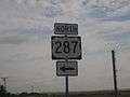
US 287 runs northwest-southeast through Childress, located equidistant from Amarillo and Wichita Falls.
-
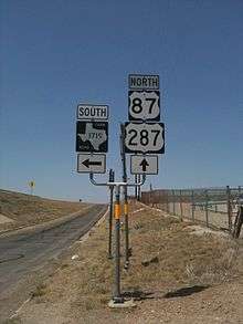
US 287 is concurrent with US 87 between Amarillo and Dumas.
-

US 287 in North Texas.
See also
 Texas portal
 U.S. Roads portal
References
- ↑ Transportation Planning and Programming Division (n.d.). "U.S. Highway No. 287". Highway Designation Files. Texas Department of Transportation. Retrieved 2008-03-05.
- ↑ Google (2008-03-05). "overview map of US 287" (Map). Google Maps. Google. Retrieved 2008-03-05.
External links
- US 287 southeast of downtown Fort Worth—from dfwfreeways.info
| U.S. Route 287 | ||
|---|---|---|
| Previous state: Terminus |
Texas | Next state: Oklahoma |