Ulamertorsuaq
| Ulamertorsuaq | |
|---|---|
 | |
| Highest point | |
| Elevation | 1,858 m (6,096 ft) |
| Listing | List of mountains in Greenland |
| Coordinates | 60°22′35″N 44°32′32″W / 60.37639°N 44.54222°WCoordinates: 60°22′35″N 44°32′32″W / 60.37639°N 44.54222°W |
| Geography | |
| Climbing | |
| First ascent | 1977 |
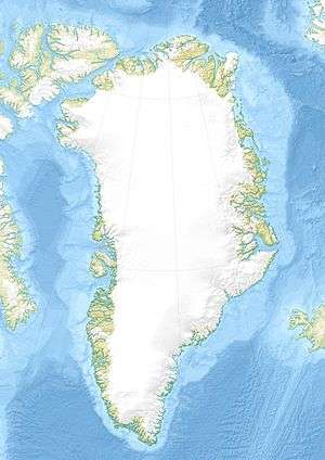

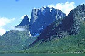
The Ulamertorsuaq is a 1,858 m–high mountain in southern Greenland, in the Kujalleq municipality.[1]
Geography
Together with Nalumasortoq and Ketil, this mountain rises in the mountainous peninsula of the mainland which forms the eastern side of the Tasermiut Fjord.[2]
The Ulamertorsuaq has four peaks with heights of 1858 m, 1843 m, 1829 m and 1825 m. The 1843 m high peak is a popular mountain among climbers because of its challenging West Side, a mighty perpendicular cliff.[3] It is also favoured for its firm granite structure, similar to other summits in the region such as Ketil and Napasorsuaq, the latter located on the other side of the Tasermiut Fjord.[4]
See also
Bibliography
- Greenland Tourism: Hiking Map South Greenland/Tasermiut fjorden – Nanortalik. 1996
References
- ↑ Gazetteer of Greenland written by Per Ivar Haug, UBiT (Universitetsbiblioteket i Trondheim), August 2005, ISBN 82-7113-114-1
- ↑ "Tasermiutsiaq". Mapcarta. Retrieved 20 April 2016.
- ↑ Kurt Albert. "Ulamertorssuaq, Moby Dick" (PDF). American Alpine Journal. Retrieved 21 April 2016.
- ↑ Michael Hjorth. "Ketil Fjeld, South Greenland, 1987". bigwall.dk. Retrieved 20 April 2016.
External links
- Existing routes on Ulamertorssuaq
- 'Ulamatorsuaq' By Dirk Jenrich
- Greenland Chapter 2: Getting into it… Big Walls!
This article is issued from Wikipedia - version of the 6/12/2016. The text is available under the Creative Commons Attribution/Share Alike but additional terms may apply for the media files.