Umm al-Qutuf
| Umm al-Qutuf אֻם אל-קֻטוּף, אום אל-קוטוף أمّ القـُطـُف | |
|---|---|
 | |
  Umm al-Qutuf | |
| Coordinates: 32°28′N 35°04′E / 32.467°N 35.067°ECoordinates: 32°28′N 35°04′E / 32.467°N 35.067°E | |
| District | Haifa |
| Council | Menashe |
| Population (2015)[1] | 1,037 |
| Name meaning | "The ruin with the St. John's-worts"[2] |
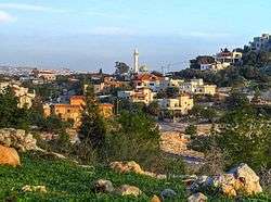
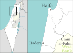
Umm al-Qutuf (Arabic: أمّ القـُطـُف; Hebrew: אֻם אל-קֻטוּף) is an Arab village in northern Israel. Located in the triangle, it falls under the jurisdiction of Menashe Regional Council. In 2015 it had a population of 1,037.
History
Pottery fragments from the Roman and Byzantine era have been found here.[3]
In 1882, during the late Ottoman era, the Palestine Exploration Fund's Survey of Western Palestine (SWP) found at Kh. Umm el Kutuf only "ruined walls."[4]

See also
References
- ↑ "List of localities, in Alphabetical order" (PDF). Israel Central Bureau of Statistics. Retrieved 16 October 2016.
- ↑ Palmer, 1881, p. 150
- ↑ Haddad, 2012, Umm el-Qutuf
- ↑ Conder and Kitchener, 1882, SWP II, p. 64
Bibliography
 |
Wikimedia Commons has media related to Um al Qutuf. |
- Conder, Claude Reignier; Kitchener, H. H. (1882). The Survey of Western Palestine: Memoirs of the Topography, Orography, Hydrography, and Archaeology. 2. London: Committee of the Palestine Exploration Fund.
- Haddad, Elie (2012-03-22). "Umm el-Qutuf" (124). Hadashot Arkheologiyot – Excavations and Surveys in Israel.
- Palmer, E. H. (1881). The Survey of Western Palestine: Arabic and English Name Lists Collected During the Survey by Lieutenants Conder and Kitchener, R. E. Transliterated and Explained by E.H. Palmer. Committee of the Palestine Exploration Fund.
External links
- Survey of Western Palestine, Map 8: IAA, Wikimedia commons

This article is issued from Wikipedia - version of the 10/20/2016. The text is available under the Creative Commons Attribution/Share Alike but additional terms may apply for the media files.