Umbogintwini
| Umbogintwini | |
|---|---|
  Umbogintwini  Umbogintwini  Umbogintwini
| |
|
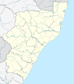
Location within Durban 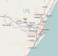 Umbogintwini | |
| Coordinates: 30°01′S 30°53′E / 30.017°S 30.883°ECoordinates: 30°01′S 30°53′E / 30.017°S 30.883°E | |
| Country | South Africa |
| Province | KwaZulu-Natal |
| Municipality | eThekwini |
| Main Place | Durban |
| Area[1] | |
| • Total | 5.47 km2 (2.11 sq mi) |
| Population (2011)[1] | |
| • Total | 105 |
| • Density | 19/km2 (50/sq mi) |
| Racial makeup (2011)[1] | |
| • Black African | 33.0% |
| • Coloured | 5.7% |
| • Indian/Asian | 15.1% |
| • White | 42.5% |
| • Other | 3.8% |
| First languages (2011)[1] | |
| • English | 43.3% |
| • Afrikaans | 21.2% |
| • Zulu | 20.2% |
| • Tsonga | 5.8% |
| • Other | 9.6% |
| Postal code (street) | 4126 |
| PO box | 4120 |
Umbogintwini (a corruption of eZimbokodweni)[2] is a town near Durban in KwaZulu-Natal, South Africa. Its post office received the corrected name in 1997.
Holiday resort on the Indian Ocean, 23 km south-west of Durban and 4 km north-east of Amanzimtoti. The name is an adaptation of Zulu Mbokodweni, ‘river of round grinding-stones’; the resort is named after the river which enters the sea there.[3]
eZimbokodweni means "site where small, round grinding stones are collected".[2]
References
- 1 2 3 4 "Sub Place Umbogintwini". Census 2011.
- 1 2 Jenkins, Elwyn (2007), Falling into place: the story of modern South African place names, David Philip Publishers, p. 76
- ↑ "Dictionary of Southern African Place Names (Public Domain)". Human Science Research Council. p. 444.
Communities of eThekwini Metropolitan Municipality, KwaZulu-Natal | |||||||||||||||
|---|---|---|---|---|---|---|---|---|---|---|---|---|---|---|---|
Seat: Durban | |||||||||||||||
| Cities and towns |
| .svg.png) | |||||||||||||
| Suburbs of Durban |
| ||||||||||||||
This article is issued from Wikipedia - version of the 8/19/2016. The text is available under the Creative Commons Attribution/Share Alike but additional terms may apply for the media files.