Voyageur Provincial Park
| Voyageur Provincial Park | |
|---|---|
|
IUCN category II (national park) | |
|
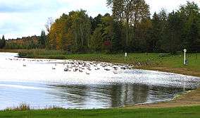
Day-use area with migrating Canada Geese | |
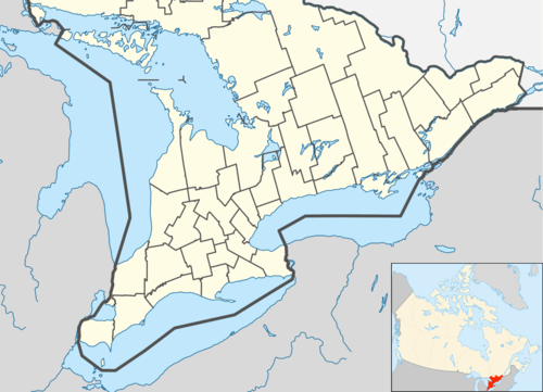  | |
| Location | Hawkesbury, Ontario |
| Coordinates | 45°33′17″N 74°27′12″W / 45.55472°N 74.45333°WCoordinates: 45°33′17″N 74°27′12″W / 45.55472°N 74.45333°W |
| Area | 1,464 hectares (3,620 acres) |
| Governing body | Ontario Parks |
Voyageur Provincial Park is a park located in eastern Ontario, Canada, opposite the once furious Long Sault rapids of the Ottawa River around which voyageurs portaged on their way upstream.[1] Established in 1966, this park was formerly known as Carillon Provincial Park.[2]
The park has 416 campsites, 110 with electrical service. Group camping is also available. The park has a day-use area and comfort stations for campers. There are two hiking trails—Coureur de Bois Trail (2 km, 1 hour) and Outouais Trail (5 km return)—both rated easy.[1]
In the winter, cross-country ski trails are available.[3]

Entrance to Voyageur Park
References
- 1 2 Voyageur, Ontario Parks Archived May 14, 2010, at the Wayback Machine.
- ↑ "Voyageur Provincial Park Management Plan" (PDF). Ontario Parks. 1992.
- ↑ "Voyageur Provincial Park". Ontario Parks.
External links
- Voyageur Provincial Park, Out There
| National parks |  | |
|---|---|---|
| Provincial parks | ||
| Conservation areas | ||
| UNESCO Biosphere Reserves | ||
| National Historic Sites of Canada | ||
| Other areas | ||
This article is issued from Wikipedia - version of the 11/18/2016. The text is available under the Creative Commons Attribution/Share Alike but additional terms may apply for the media files.