Yellow River (Florida)
| Yellow River | |
|---|---|
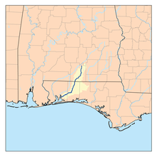 Map of the Yellow River | |
| Basin | |
| Main source | 31°27′24″N 86°20′05″W / 31.45655°N 86.33467°W |
| River mouth | 30°33′27″N 86°59′43″W / 30.55741°N 86.99524°WCoordinates: 30°33′27″N 86°59′43″W / 30.55741°N 86.99524°W |
| Physical characteristics | |
| Length | 118 miles (190 km) |
The Yellow River is a 118-mile-long (190 km)[1] river in the southern United States which runs through Alabama and Florida. It empties into Blackwater Bay, an arm of Pensacola Bay.
References
- ↑ U.S. Geological Survey. National Hydrography Dataset high-resolution flowline data. The National Map, accessed April 15, 2011
This article is issued from Wikipedia - version of the 9/11/2016. The text is available under the Creative Commons Attribution/Share Alike but additional terms may apply for the media files.