Zonnebloem
| Zonnebloem | |
|---|---|
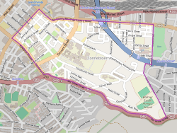 Street map of Zonnebloem | |
  Zonnebloem  Zonnebloem  Zonnebloem
| |
|
Location within Cape Town 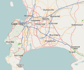 Zonnebloem | |
| Coordinates: 33°55′52″S 18°25′59″E / 33.931°S 18.433°ECoordinates: 33°55′52″S 18°25′59″E / 33.931°S 18.433°E | |
| Country | South Africa |
| Province | Western Cape |
| Municipality | City of Cape Town |
| Main Place | Cape Town |
| Area[1] | |
| • Total | 1.42 km2 (0.55 sq mi) |
| Population (2011)[1] | |
| • Total | 5,122 |
| • Density | 3,600/km2 (9,300/sq mi) |
| Racial makeup (2011)[1] | |
| • Black African | 39.4% |
| • Coloured | 31.4% |
| • Indian/Asian | 2.2% |
| • White | 19.6% |
| • Other | 7.4% |
| First languages (2011)[1] | |
| • English | 47.1% |
| • Afrikaans | 26.6% |
| • Xhosa | 8.5% |
| • Zulu | 1.6% |
| • Other | 16.2% |
| Postal code (street) | 7925 |
Zonnebloem (Dutch for sunflower)[2] is a suburb in City of Cape Town metropolitan municipality in the Western Cape province of South Africa, previously part of District Six.
It was a farming estate until the early 19th century, when it became a suburb of Cape Town as the population and city boundaries grew.[3] Zonnebloem became a home to freed slaves, merchants, labourers and immigrants. During apartheid, the area of District Six was declared a white-only area and the previous residents were evicted.
The suburb hosts the Cape Town Campus of the Cape Peninsula University of Technology.
References
- 1 2 3 4 "Sub Place Zonnebloem". Census 2011.
- ↑ "Zonnebloem Information". WhereToStay. Retrieved 4 February 2014.
- ↑ "District Six". The Crossings Project. Devon County Council. Retrieved 4 February 2014.
.svg.png)
This article is issued from Wikipedia - version of the 10/2/2016. The text is available under the Creative Commons Attribution/Share Alike but additional terms may apply for the media files.