Alberta Highway 72
| ||||
|---|---|---|---|---|
 | ||||
| Route information | ||||
| Length: | 33.5 km[1] (20.8 mi) | |||
| Major junctions | ||||
| West end: |
  Hwy 2 / Hwy 2A southeast of Crossfield Hwy 2 / Hwy 2A southeast of Crossfield | |||
| East end: |
  Hwy 9 / Hwy 806 at Beiseker Hwy 9 / Hwy 806 at Beiseker | |||
| Location | ||||
| Specialized and rural municipalities: | Rocky View County | |||
| Villages: | Beiseker | |||
| Highway system | ||||
|
Provincial highways in Alberta
| ||||


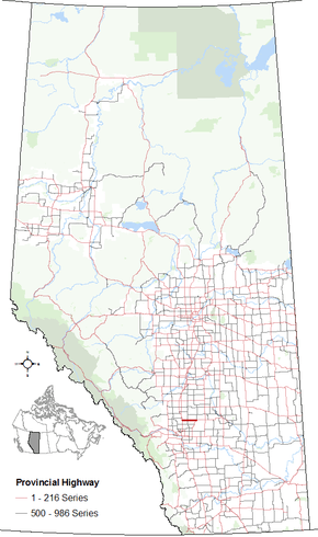
Alberta Provincial Highway No. 72 is an east–west highway in central Alberta, Canada.[2]
In the west, Highway 72 begins at its intersection with Highway 2 (Queen Elizabeth II Highway)/Highway 2A at Exit 295 southeast of the Town of Crossfield and ends at Highways 9 and 806 at the Village of Beiseker. The entire stretch of Highway 72 is located wholly within Rocky View County.[1][3]
Major intersections
| Rural/specialized municipality | Location | km | mi | Destinations | Notes |
|---|---|---|---|---|---|
| Rocky View County | | 0 | 0.0 | Hwy 2 (Exit 295) – Calgary, Red Deer, Edmonton Hwy 2A north – Crossfield, Carstairs | Interchange Hwy 72 begins |
| | 12 | 7.5 |  Hwy 791 Hwy 791 | ||
| Beiseker | 33 | 21 | Hwy 9 – Irricana, Calgary, Drumheller, Hanna Hwy 806 north – Acme, Linden | Hwy 72 ends | |
| 1.000 mi = 1.609 km; 1.000 km = 0.621 mi | |||||
References
- 1 2 "2015 Provincial Highway 1-216 Progress Chart" (PDF). Alberta Transportation. March 2015. Archived (PDF) from the original on April 10, 2016. Retrieved October 31, 2016.
- ↑ Provincial Highways Designation Order, Alberta Transportation, p. 10
- ↑ Google (October 31, 2016). "Highway 72 in Alberta" (Map). Google Maps. Google. Retrieved October 31, 2016.
This article is issued from Wikipedia - version of the 10/31/2016. The text is available under the Creative Commons Attribution/Share Alike but additional terms may apply for the media files.