Ames, Nebraska
| Ames, Nebraska | |
|---|---|
  Ames Location within the state of Nebraska | |
| Coordinates: 41°24′23″N 95°59′47″W / 41.40639°N 95.99639°WCoordinates: 41°24′23″N 95°59′47″W / 41.40639°N 95.99639°W | |
| Country | United States |
| State | Nebraska |
| County | Dodge |
| Area | |
| • Total | 0.33 sq mi (0.85 km2) |
| • Land | 0.33 sq mi (0.85 km2) |
| • Water | 0.0 sq mi (0.0 km2) |
| Elevation | 1,227 ft (374 m) |
| Population (2010) | |
| • Total | 24 |
| • Density | 74/sq mi (28.4/km2) |
Ames is an unincorporated community and census-designated place in southern Dodge County, Nebraska, United States. As of the 2010 census it had a population of 24.[1]
It lies along U.S. Route 30 west of the city of Fremont, the county seat of Dodge County.[2] Its elevation is 1,227 feet (374 m) above sea level, and it is located at about 41°27′8″N 96°37′30″W / 41.45222°N 96.62500°W (41.4523625, -96.6251658). Although Ames is unincorporated, it has a post office, with the ZIP code of 68621.[3]
History
A post office was established at Ames in 1885, and remained in operation until it was discontinued in 1985.[4] The community was likely named for Oakes Ames, a Union Pacific Railroad official.[5] Ames was a station and shipping point on the Union Pacific Railroad.[6]
References
- ↑ "Geographic Identifiers: 2010 Demographic Profile Data (G001): Ames CDP, Nebraska". U.S. Census Bureau, American Factfinder. Retrieved November 3, 2015.
- ↑ Rand McNally. The Road Atlas '08. Chicago: Rand McNally, 2008, p. 63.
- ↑ Zip Code Lookup Archived June 15, 2011, at the Wayback Machine.
- ↑ "Dodge County". Jim Forte Postal History. Retrieved 25 August 2014.
- ↑ Geographic Names Information System Feature Detail Report, Geographic Names Information System, 1979-03-09. Accessed 2008-04-26.
- ↑ William Henry Buss; Thomas T. Osterman (1921). History of Dodge and Washington Counties, Nebraska, and Their People. American Historical Society. p. 309.
Municipalities and communities of Dodge County, Nebraska, United States | ||
|---|---|---|
| Cities | 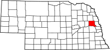 | |
| Villages | ||
| Townships | ||
| CDPs | ||
| Unincorporated communities | ||
| Ghost towns | ||
| Footnotes | ‡This populated place also has portions in an adjacent county or counties | |