Arlington, Wyoming
| Arlington, Wyoming | |
|---|---|
| Census-designated place | |
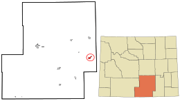 Location in Carbon County and the state of Wyoming. | |
| Coordinates: 41°35′41″N 106°12′30″W / 41.59472°N 106.20833°WCoordinates: 41°35′41″N 106°12′30″W / 41.59472°N 106.20833°W | |
| Country | United States |
| State | Wyoming |
| County | Carbon |
| Area | |
| • Total | 4.1 sq mi (10.5 km2) |
| • Land | 4.1 sq mi (10.5 km2) |
| • Water | 0.0 sq mi (0.0 km2) |
| Elevation | 7,707 ft (2,349 m) |
| Population (2010)[1] | |
| • Total | 25 |
| • Density | 6.2/sq mi (2.4/km2) |
| Time zone | Mountain (MST) (UTC-7) |
| • Summer (DST) | MDT (UTC-6) |
| Area code(s) | 307 |
| FIPS code | 56-03245[2] |
| GNIS feature ID | 1609063[3] |
|
Arlington | |
 | |
   | |
| Location | South of Interstate 80 |
|---|---|
| Coordinates | 41°35′41″N 106°12′30″W / 41.59472°N 106.20833°W |
| Built | 1860 |
| NRHP Reference # | 83004268[4] |
| Added to NRHP | November 25, 1983 |
Arlington (also Rockdale)[5] is a census-designated place (CDP) in southeastern Carbon County, Wyoming, United States. The population was 25 at the 2010 census.[6]
Geography
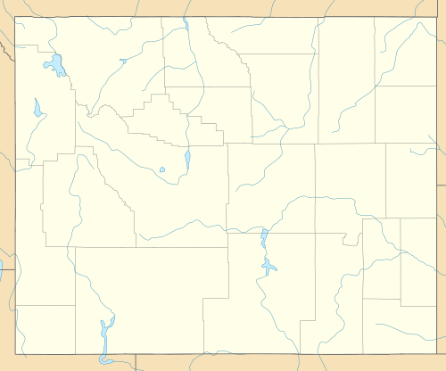
Arlington lies at the intersection of Interstate 80 and WYO 13,[7] northwest of Laramie and east of the city of Rawlins, the county seat of Carbon County.[8] Its elevation is 7,707 feet (2,349 m), and it is located at 41°35′41″N 106°12′30″W / 41.59472°N 106.20833°W (41.5946899, -106.2083459).[5]
According to the United States Census Bureau, the CDP has a total area of 4.1 square miles (10.5 km2), all of it land.[6]
History
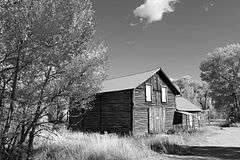
In its earliest years, Arlington was a commercial stop along the Overland Trail.[9] Founded circa 1860,[4] it began with the establishment of a bridge and stage stop at the crossing of Rock Creek, after which it was named until the early twentieth century.[9] In 1983, the community was listed on the National Register of Historic Places as a historic district for its nineteenth-century significance.[4]
In 1882, a post office was established at Rock Creek under the name of "Rock Dale."[9] Except for a gap in 1924 and 1925, a post office with the name of Arlington was operated in the community from 1902 to 1943.[10]
References
- ↑ "2010 City Population and Housing Occupancy Status". U.S. Census Bureau. Archived from the original on July 26, 2011. Retrieved July 13, 2012.
- ↑ "American FactFinder". United States Census Bureau. Archived from the original on 2013-09-11. Retrieved 2008-01-31.
- ↑ "US Board on Geographic Names". United States Geological Survey. 2007-10-25. Retrieved 2008-01-31.
- 1 2 3 National Park Service (2009-03-13). "National Register Information System". National Register of Historic Places. National Park Service.
- 1 2 U.S. Geological Survey Geographic Names Information System: Arlington, Wyoming
- 1 2 "Geographic Identifiers: 2010 Demographic Profile Data (G001): Arlington CDP, Wyoming". U.S. Census Bureau, American Factfinder. Retrieved October 1, 2015.
- ↑ Topographical map of Arlington, United States Geological Survey. Accessed 2009-08-11.
- ↑ Rand McNally. The Road Atlas '05. Chicago: Rand McNally, 2005, 116.
- 1 2 3 Rock Creek Stage Station Historic District, Wyoming State Historic Preservation Office, 2009-07-16. Accessed 2009-08-11.
- ↑ U.S. Geological Survey Geographic Names Information System: Arlington Post Office
Municipalities and communities of Carbon County, Wyoming, United States | ||
|---|---|---|
| Cities |  | |
| Towns | ||
| CDPs | ||
| Unincorporated communities | ||
| Ghost towns | ||