Baniyani
| Baniyani | |
|---|---|
| Village Development Committee | |
 Map of the Village Development Committees in Jhapa District | |
| Country |
 Nepal Nepal |
| Zone | Mechi Zone |
| District | Jhapa District |
| Population (1991) | |
| • Total | 5,043 |
| Time zone | Nepal Time (UTC+5:45) |
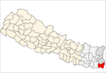
Baniyani (Nepali: बनियानी) is a Village Development Committee in Jhapa District in the Mechi Zone of south-eastern Nepal. At the time of the 1991 Nepal census it had a population of 5043 people residing in 985 individual households.[1] Laxmi Higher Secondary School, Baniyani Health-Post, and an Armed-Force Camp are located in the vicinity. Mechi River flows to the east on the border of Nepal and India.
Demographics
Many ethnic groups live in the region, such as: Rai, Newar, Tamang, Limbu, Meche, Koche, Rajbanshi, Gangain, Muslim, and Gaine.
References
- ↑ "Nepal Census 2001". Nepal's Village Development Committees. Digital Himalaya. Archived from the original on 12 October 2008. Retrieved 24 November 2008.
Coordinates: 26°26′N 88°03′E / 26.44°N 88.05°E
This article is issued from Wikipedia - version of the 10/25/2016. The text is available under the Creative Commons Attribution/Share Alike but additional terms may apply for the media files.