Bent, New Mexico
| Bent, New Mexico | |
|---|---|
| Census-designated place | |
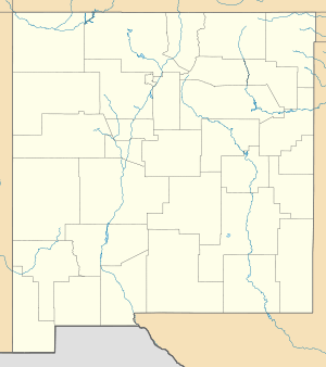  Bent, New Mexico | |
| Coordinates: 33°09′31″N 105°51′25″W / 33.15861°N 105.85694°WCoordinates: 33°09′31″N 105°51′25″W / 33.15861°N 105.85694°W | |
| Country | United States |
| State | New Mexico |
| County | Otero |
| Area[1] | |
| • Total | 6.135 sq mi (15.89 km2) |
| • Land | 6.132 sq mi (15.88 km2) |
| • Water | 0.003 sq mi (0.008 km2) |
| Elevation | 5,823 ft (1,775 m) |
| Population (2010)[2] | |
| • Total | 119 |
| • Density | 19/sq mi (7.5/km2) |
| Time zone | Mountain (MST) (UTC-7) |
| • Summer (DST) | MDT (UTC-6) |
| ZIP code | 88314 |
| Area code(s) | 575 |
| GNIS feature ID | 903754[3] |
Bent is a census-designated place in Otero County, New Mexico, United States. Its population was 119 as of the 2010 census. Bent has a post office with ZIP code 88314.[4][5] U.S. Route 70 passes through the community.
History
A post office called Bent has been in operation since 1906.[6] The community most likely was named after a local prospector.[7]
References
- ↑ "US Gazetteer files: 2010, 2000, and 1990". United States Census Bureau. 2011-02-12. Retrieved 2011-04-23.
- ↑ "American FactFinder". United States Census Bureau. Archived from the original on 2013-09-11. Retrieved 2011-05-14.
- ↑ "Bent". Geographic Names Information System. United States Geological Survey.
- ↑ United States Postal Service (2012). "USPS - Look Up a ZIP Code". Retrieved 2012-02-15.
- ↑ "Postmaster Finder - Post Offices by ZIP Code". United States Postal Service. Retrieved August 8, 2013.
- ↑ "Otero County". Jim Forte Postal History. Retrieved 31 October 2015.
- ↑ "Odd names abound in this state". Reading Eagle. Jan 1, 1970. p. 2. Retrieved 31 October 2015.
Municipalities and communities of Otero County, New Mexico, United States | ||
|---|---|---|
| City | 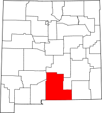 | |
| Villages | ||
| CDPs | ||
| Other unincorporated communities | ||
| Indian reservation | ||
| Footnotes | ‡This populated place also has portions in an adjacent county or counties | |
This article is issued from Wikipedia - version of the 10/31/2016. The text is available under the Creative Commons Attribution/Share Alike but additional terms may apply for the media files.