Castor Flood Meadows
| Site of Special Scientific Interest | |
 | |
| Area of Search | Cambridgeshire |
|---|---|
| Grid reference | TL 123 972 [1] |
| Interest | Biological |
| Area | 41.8 hectares[1] |
| Notification | 1986[1] |
| Location map | Magic Map |
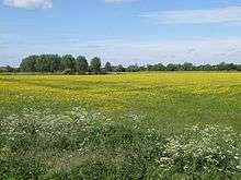
Castor Flood Meadows is a 41.8 hectare biological Site of Special Scientific Interest on the western outskirts of Peterborough in Cambridgeshire.[1][2]
This site on the banks of the River Nene is a remnant of formerly extensive flood meadows. Flora include slender tufted-sedges, early marsh-orchids and the nationally restricted narrow-leaved water-dropwort.[3]
The Hereward Way long distance footpath goes through the site.[2]
References
- 1 2 3 4 "Designated Sites View: Castor Flood Meadows". Sites of Special Scientific Interest. Natural England. Retrieved 30 November 2016.
- 1 2 "Map of Castor Flood Meadows". Sites of Special Scientific Interest. Natural England. Retrieved 30 November 2016.
- ↑ "Castor Flood Meadows citation" (PDF). Sites of Special Scientific Interest. Natural England. Retrieved 30 November 2016.
Coordinates: 52°33′43″N 0°20′42″W / 52.562°N 0.345°W
This article is issued from Wikipedia - version of the 11/30/2016. The text is available under the Creative Commons Attribution/Share Alike but additional terms may apply for the media files.