Charlos Heights, Montana
| Charlos Heights, Montana | |
|---|---|
| Census-designated place | |
  Charlos Heights | |
| Coordinates: 46°7′34″N 114°10′40″W / 46.12611°N 114.17778°WCoordinates: 46°7′34″N 114°10′40″W / 46.12611°N 114.17778°W | |
| Country | United States |
| State | Montana |
| County | Ravalli |
| Area | |
| • Total | 1.2 sq mi (3.0 km2) |
| • Land | 1.2 sq mi (3.0 km2) |
| • Water | 0.0 sq mi (0.0 km2) |
| Elevation | 3,741 ft (1,140 m) |
| Population (2010) | |
| • Total | 120 |
| • Density | 105/sq mi (40.7/km2) |
| Time zone | Mountain (MST) (UTC-7) |
| • Summer (DST) | MDT (UTC-6) |
| ZIP code | 59840 |
| Area code(s) | 406 |
| FIPS code | 30-13975 |
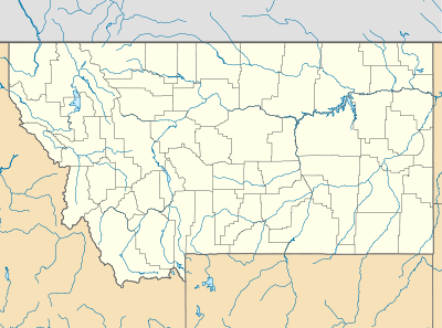
Charlos Heights or Charlo's Heights (Salish: nkʷalíʔps [1]) is a census-designated place (CDP) in Ravalli County, Montana, United States. The population was 120 at the 2010 census.[2]
Geography
Charlos Heights is located at 46°07′35″N 114°10′40″W / 46.12631°N 114.17787°W, along U.S. Route 93 in the valley of the Bitterroot River. It is 9 miles (14 km) south of Hamilton and 8 miles (13 km) north of Darby.
According to the United States Census Bureau, the CDP has a total area of 1.2 square miles (3.0 km2), all of it land.[2]
The area south of Charlos Heights is called ɫmq̓ʷcn̓é in Salish.[1]
References
- 1 2 Tachini, Pete; Louie Adams, Sophie Mays, Mary Lucy Parker, Johnny Arlee, Frances Vanderburg, Lucy Vanderburg, Diana Christopher-Cote (1998). nyoʻnuntn q̓éymin, Flathead Nation Salish dictionary. Pablo, Montana: Bilingual Education Department, Salish Kootenai College. p. 28.
- 1 2 "Geographic Identifiers: 2010 Demographic Profile Data (DP-1): Charlos Heights CDP, Montana". U.S. Census Bureau, American Factfinder. Retrieved March 22, 2013.
Municipalities and communities of Ravalli County, Montana, United States | ||
|---|---|---|
| City | 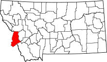 | |
| Towns | ||
| CDPs | ||
| Other communities | ||
This article is issued from Wikipedia - version of the 12/6/2013. The text is available under the Creative Commons Attribution/Share Alike but additional terms may apply for the media files.