Desali
| Desali | |
|---|---|
| Village | |
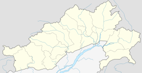  Desali   Desali Location in Arunachal Pradesh, India | |
| Coordinates: 28°10′19″N 95°49′28″E / 28.1719°N 95.8245°ECoordinates: 28°10′19″N 95°49′28″E / 28.1719°N 95.8245°E | |
| Country |
 India India |
| State | Arunachal Pradesh |
| District | Lower Dibang Valley district |
| Elevation | 1,240 m (4,070 ft) |
| Languages | |
| • Official | English |
| Time zone | IST (UTC+05:30) |
| Vehicle registration | AR |
Desali is a village Panchayat in Hunli-Desali Tehsil of Lower Dibang Valley district in the north-eastern state of Arunachal Pradesh, India.
Location
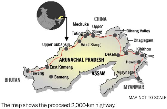
It is located on the 2,000-kilometre-long (1,200 mi) proposed Mago-Thingbu to Vijaynagar Arunachal Pradesh Frontier Highway along the McMahon Line,[1][2][3][4] alignment map of which can be seen here and here.[5]
See also
References
- ↑ "Top officials to meet to expedite road building along China border". Dipak Kumar Dash. timesofindia.indiatimes.com. Retrieved 27 October 2014.
- ↑ "Narendra Modi government to provide funds for restoration of damaged highways". http://www.dnaindia.com. Retrieved 27 October 2014. External link in
|publisher=(help) - ↑ "Indian Government Plans Highway Along Disputed China Border". Ankit Panda. thediplomat.com. Retrieved 27 October 2014.
- ↑ "Govt planning road along McMohan line in Arunachal Pradesh: Kiren Rijiju". Live Mint. Retrieved 2014-10-26.
- ↑ "China warns India against paving road in Arunachal". Ajay Banerjee. tribuneindia.com. Retrieved 2014-10-26.
 |
 Tibet Autonomous Region, China Tibet Autonomous Region, China |
| ||
 Eastern Zone, Bhutan Eastern Zone, Bhutan |
 |
 Kachin State, Burma Kachin State, Burma | ||
| ||||
 | ||||
| Assam | Nagaland | Sagaing Region, Burma |



This article is issued from Wikipedia - version of the 11/2/2016. The text is available under the Creative Commons Attribution/Share Alike but additional terms may apply for the media files.