Hobhouse, Free State
| Hobhouse | |
|---|---|
|
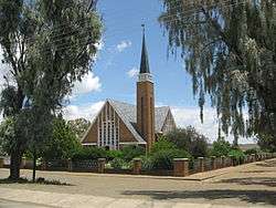
Hobhouse, Dutch Reformed Church | |
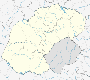  Hobhouse  Hobhouse  Hobhouse
| |
| Coordinates: 29°32′S 27°09′E / 29.533°S 27.150°ECoordinates: 29°32′S 27°09′E / 29.533°S 27.150°E | |
| Country | South Africa |
| Province | Free State |
| District | Thabo Mofutsanyane |
| Municipality | Mantsopa |
| Established | 1912 |
| Area[1] | |
| • Total | 12.6 km2 (4.9 sq mi) |
| Population (2011)[1] | |
| • Total | 3,980 |
| • Density | 320/km2 (820/sq mi) |
| Racial makeup (2011)[1] | |
| • Black African | 94.5% |
| • Coloured | 2.1% |
| • Indian/Asian | 0.4% |
| • White | 2.8% |
| • Other | 0.2% |
| First languages (2011)[1] | |
| • Sotho | 91.7% |
| • Afrikaans | 3.9% |
| • English | 1.7% |
| • Sign language | 1.4% |
| • Other | 1.3% |
| Postal code (street) | 9740 |
| PO box | 9740 |
| Area code | 051 |
Hobhouse is a small farming town in the Free State province of South Africa, named after welfare campaigner Emily Hobhouse. Maize, wheat, cheese and livestock are produced here.
Town 32 km north-east of Wepener and 51 km south-west of Ladybrand, near the Lesotho border. It was laid out on the farm Poortjie in 1912 and attained municipal status in 1913. Named after Emily Hobhouse (1860-1926), author and philanthropist who brought to public notice abuses in concentration camps during the Anglo-Boer War.[2]
References
- 1 2 3 4 Sum of the Main Places Dipelaneng and Hobhouse from Census 2011.
- ↑ "Dictionary of Southern African Place Names (Public Domain)". Human Science Research Council. p. 212.
Municipalities and communities of Thabo Mofutsanyana District Municipality, Free State | ||
|---|---|---|
District seat: Phuthaditjhaba (Witsieshoek) | ||
| Setsoto | .svg.png) | |
| Dihlabeng | ||
| Nketoana | ||
| Maluti-a-Phofung | ||
| Phumelela | ||
| Mantsopa | ||
This article is issued from Wikipedia - version of the 8/18/2016. The text is available under the Creative Commons Attribution/Share Alike but additional terms may apply for the media files.