Donji Vakuf
| Donji Vakuf Доњи Вакуф | |
|---|---|
| Municipality and town | |
 | |
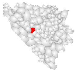 Location of Donji Vakuf within Bosnia and Herzegovina. | |
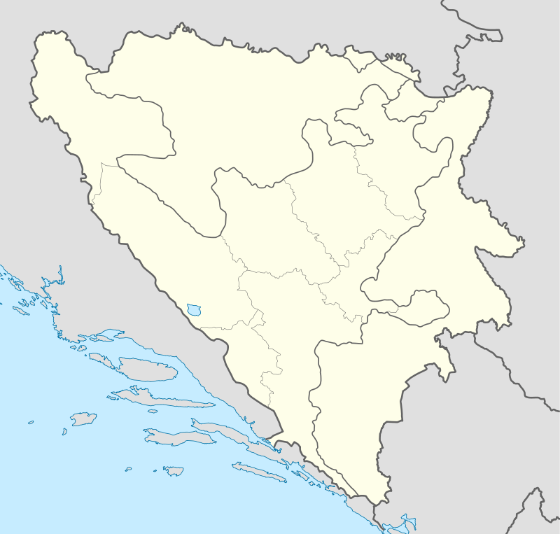  Donji Vakuf Location of Donji Vakuf | |
| Coordinates: 44°09′N 17°24′E / 44.150°N 17.400°E | |
| Country |
 Bosnia and Herzegovina Bosnia and Herzegovina |
| Entity | Federation of Bosnia and Herzegovina |
| Government | |
| • Municipality president | Husein Sušić (SDA) |
| Area | |
| • Total | 320 km2 (120 sq mi) |
| Population (2013 census) | |
| • Total | 24,232 |
| • Density | 46/km2 (120/sq mi) |
| Time zone | CET (UTC+1) |
| • Summer (DST) | CEST (UTC+2) |
| Area code(s) | +387 30 |
| Website | http://www.donji-vakuf.ba |
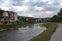
Donji Vakuf (pronounced [dɔ̂ːɲiː vǎkuf]) (Cyrillic: Доњи Вакуф) is a town and municipality in central Bosnia and Herzegovina, located between Jajce, Bugojno and Travnik. It is under the administration of the Federation of Bosnia and Herzegovina. It was founded by Malkoçoğlu İbrahim Bey in 1572 and was known as "Aşağı Vakıf" ("Lower foundation" in Turkish). Donji Vakuf is Bosnian translation of "Aşağı Vakıf".
Settlements
• Babin Potok • Babino Selo • Barice • Blagaj • Brda • Brdo • Brezičani • Ćehajići • Ćemalovići • Daljan • Dobro Brdo • Doganovci • Dolovi • Donji Rasavci • Donji Vakuf • Đulovići • Fakići • Fonjge • Galešići • Grabantići • Gredina • Grič • Guvna • Hemići • Jablan • Jemanlići • Karići • Keže • Komar • Korenići • Košćani • Kovačevići • Krivače • Kutanja • Ljuša • Makitani • Novo Selo • Oborci • Orahovljani • Petkovići • Piljužići • Pobrđani • Ponjavići • Potkraj • Pribraća • Prisika • Prusac • Rasavci • Rastičevo • Rudina • Ruska Pilana • Sandžak • Semin • Silajdževina • Slatina • Sokolina • Staro Selo • Suhodol • Sultanovići • Suljići • Šahmani • Rahmani • Šeherdžik • Šutkovići • Torlakovac • Urija • Vlađevići • Vrljaj.
History
From 1929 to 1941, Donji Vakuf was part of the Vrbas Banovina of the Kingdom of Yugoslavia. During the Bosnian War from 1992 to 1995, the town was within the territory controlled by Bosnian Serbs. It was liberated by Bosnian Government Army (ARBiH) in 1995.[1]
Demographics
| Ethnic Composition | |||||||||||||
| Year | Serb | % | Bosniaks | % | Croats | % | Yugoslavs | % | Others | % | Total | ||
|---|---|---|---|---|---|---|---|---|---|---|---|---|---|
| 1961 | 7,870 | 49.08% | 6,289 | 39.22% | 976 | 6.09% | 850 | 5.30% | 51 | 0.32% | 16,036 | ||
| 1971 | 8,767 | 42,99% | 10,528 | 51,62% | 924 | 4,53% | 90 | 0,44% | 84 | 0,42% | 20,393 | ||
| 1981 | 8,574 | 37.93% | 11,600 | 51.31% | 635 | 2.81% | 1,592 | 7.04% | 266 | 1.18% | 22,606 | ||
| 1991 | 9,375 | 38.69% | 13,393 | 55.23% | 686 | 2.83% | 622 | 2.57% | 156 | 0.64% | 24,232 | ||
Tourism
The village of Prusac lies just outside Donji Vakuf. Bosniaks make a pilgrimage to the nearby holy site of Ajvatovica in the month of June. It is one of the biggest events in the whole of Bosnia.
Twin towns — Sister cities
Donji Vakuf is twinned with:
References
External links
Municipalities of the Central Bosnia Canton | ||
|---|---|---|
 | ||







Coordinates: 44°09′N 17°24′E / 44.150°N 17.400°E
 |
Wikimedia Commons has media related to Donji Vakuf. |