East Barre, Vermont
| East Barre, Vermont | |
|---|---|
| Census-designated place | |
|
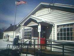
Post office in East Barre | |
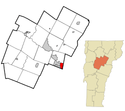 Location in Washington County and the state of Vermont | |
| Coordinates: 44°9′29″N 72°27′1″W / 44.15806°N 72.45028°WCoordinates: 44°9′29″N 72°27′1″W / 44.15806°N 72.45028°W | |
| Country | United States |
| State | Vermont |
| County | Washington |
| Area | |
| • Total | 2.69 sq mi (6.96 km2) |
| • Land | 2.67 sq mi (6.92 km2) |
| • Water | 0.02 sq mi (0.04 km2) |
| Elevation | 1,130 ft (340 m) |
| Population (2010) | |
| • Total | 826(about as many students that attend U32 Middle and High School) |
| Time zone | Eastern (EST) (UTC-5) |
| • Summer (DST) | EDT (UTC-4) |
| ZIP code | 05649 |
| Area code(s) | 802 |
| FIPS code | 50-19075[1] |
East Barre is a census-designated place (CDP) in the town of Barre, Washington County, Vermont, United States. The population of the CDP was 826 at the 2010 census.[2] Prior to 2010, East Barre was part of the Graniteville-East Barre CDP, which consisted of three unincorporated villages in the town: Graniteville, East Barre, and Websterville.[3]
Geography
According to the United States Census Bureau, the East Barre CDP has a total area of 2.69 square miles (6.96 km2), of which 2.67 square miles (6.92 km2) is land and 0.015 square miles (0.04 km2), or 0.52%, was water.[4]
References
- ↑ "American FactFinder". United States Census Bureau. Retrieved 2008-01-31.
- ↑ "Profile of General Population and Housing Characteristics: 2010 Demographic Profile Data (DP-1): East Barre CDP, Vermont". U.S. Census Bureau, American Factfinder. Retrieved September 19, 2012.
- ↑ Local History accessed March 3, 2008
- ↑ "Geographic Identifiers: 2010 Demographic Profile Data (G001): East Barre CDP, Vermont". U.S. Census Bureau, American Factfinder. Retrieved September 19, 2012.
Municipalities and communities of Washington County, Vermont, United States | ||
|---|---|---|
| Cities |  | |
| Towns | ||
| Villages | ||
| CDPs | ||
| Other communities | ||
This article is issued from Wikipedia - version of the 11/1/2015. The text is available under the Creative Commons Attribution/Share Alike but additional terms may apply for the media files.