Balfour, Eastern Cape
| Balfour | |
|---|---|
  Balfour  Balfour  Balfour
| |
| Coordinates: 32°32′24″S 26°40′23″E / 32.54000°S 26.67306°ECoordinates: 32°32′24″S 26°40′23″E / 32.54000°S 26.67306°E | |
| Country | South Africa |
| Province | Eastern Cape |
| District | Amathole |
| Municipality | Raymond Mhlaba |
| Area[1] | |
| • Total | 7.98 km2 (3.08 sq mi) |
| Population (2011)[1] | |
| • Total | 3,102 |
| • Density | 390/km2 (1,000/sq mi) |
| Racial makeup (2011)[1] | |
| • Black African | 96.9% |
| • Coloured | 3.0% |
| • Other | 0.1% |
| First languages (2011)[1] | |
| • Xhosa | 95.2% |
| • Afrikaans | 3.2% |
| • Other | 1.5% |
| Postal code (street) | 5740 |
| PO box | 5740 |
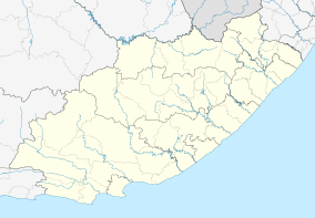
Balfour is a town in Raymond Mhlaba Municipality, Amatole District Municipality, in the Eastern Cape province of South Africa.
The village, which lies at the foot of the Katberg, was established as a mission station of the Glasgow Missionary Society in 1828 by John Ross and McDiarmid, and named after Robert Balfour, first Secretary of the Society.[2]
Throughout the nine Frontier Wars, the town experienced some heavy fighting.[3] Today, tobacco, citrus, wool and beef farming are practised in the area.[3]
References
- 1 2 3 4 "Main Place Balfour". Census 2011.
- ↑ "Dictionary of Southern African Place Names (Public Domain)". Human Science Research Council. p. 67.
- 1 2 "Balfour". South Africa Travel & Tourist Guide. Archived from the original on 4 March 2016. Retrieved 5 May 2013.
Municipalities and communities of Amathole District Municipality, Eastern Cape | ||
|---|---|---|
District seat: East London | ||
| Amahlathi | .svg.png) | |
| Great Kei | ||
| Mbhashe | ||
| Mnquma | ||
| Ngqushwa | ||
| Raymond Mhlaba | ||
This article is issued from Wikipedia - version of the 10/24/2016. The text is available under the Creative Commons Attribution/Share Alike but additional terms may apply for the media files.