Elsmere, Kentucky
| Elsmere, Kentucky | |
|---|---|
| City | |
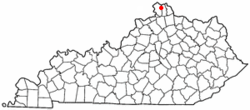 Location of Elsmere, Kentucky | |
| Coordinates: 39°0′5″N 84°36′11″W / 39.00139°N 84.60306°WCoordinates: 39°0′5″N 84°36′11″W / 39.00139°N 84.60306°W | |
| Country | United States |
| State | Kentucky |
| County | Kenton |
| Incorporated | May 11, 1896 |
| Government | |
| • Type | Mayor-Council |
| • Mayor | Marty Lenhof |
| Area | |
| • Total | 2.5 sq mi (6.5 km2) |
| • Land | 2.5 sq mi (6.5 km2) |
| • Water | 0.0 sq mi (0.0 km2) |
| Elevation | 919 ft (280 m) |
| Population (2010) | |
| • Total | 8,451 |
| • Density | 3,256.2/sq mi (1,257.2/km2) |
| Time zone | Eastern (EST) (UTC-5) |
| • Summer (DST) | EDT (UTC-4) |
| ZIP code | 41018 |
| Area code(s) | 859 |
| FIPS code | 21-24778 |
| GNIS feature ID | 0491746 |
| Website | http://www.cityofelsmere.com/ |
Elsmere is a home rule-class city[1] in Kenton County, Kentucky, in the United States. The population was 8,451 at the 2010 census.
Geography
Elsmere is located at 39°0′5″N 84°36′11″W / 39.00139°N 84.60306°W (39.001475, -84.603116).[2]
According to the United States Census Bureau, the city has a total area of 2.5 square miles (6.5 km2), all land.
History
The community was first settled in 1885 as South Erlanger. Elsmere organized as a city in 1896, renamed after Elsmere Avenue in Norwood, Ohio, the hometown of one of its founders.[3][4]
Government
In 1998, Billy Bradford was elected mayor of Elsmere, the first African-American mayor elected in Northern Kentucky. He served 12 years (three terms), and now serves as a member of City Council. The current mayor of Elsmere is Marty Lenhof.[5]
Economy
Regal-Beloit (formerly Emerson Power Transmission[6]) and L'Oréal[7] have facilities in an unincorporated pocket of Kenton County surrounded by Elsmere. The area has a Florence mailing address.[8] Mazak's North American headquarters are in Elsmere.[9]
Education
Both the cities of Elsmere and adjacent Erlanger share a public school system. The following schools are shared by the two cities:[10]
Primary schools
- Arnett Elementary School
- Howell Elementary School
- Lindeman Elementary School
- Miles Elementary School
- Tichenor Middle School
Secondary schools
Demographics
| Historical population | |||
|---|---|---|---|
| Census | Pop. | %± | |
| 1900 | 519 | — | |
| 1910 | 900 | 73.4% | |
| 1920 | 919 | 2.1% | |
| 1930 | 2,917 | 217.4% | |
| 1940 | 2,885 | −1.1% | |
| 1950 | 3,483 | 20.7% | |
| 1960 | 4,607 | 32.3% | |
| 1970 | 5,161 | 12.0% | |
| 1980 | 7,203 | 39.6% | |
| 1990 | 6,847 | −4.9% | |
| 2000 | 8,139 | 18.9% | |
| 2010 | 8,451 | 3.8% | |
| Est. 2015 | 8,536 | [11] | 1.0% |
According to the 2000 U.S. census, there were 7,301 people, 3,132 households, and 1,783 families residing in the city. The racial makeup was 91 percent White, 4 percent Black, and 2 percent Hispanic.
References
- ↑ "Summary and Reference Guide to House Bill 331 City Classification Reform" (PDF). Kentucky League of Cities. Retrieved December 30, 2014.
- ↑ "US Gazetteer files: 2010, 2000, and 1990". United States Census Bureau. 2011-02-12. Retrieved 2011-04-23.
- ↑ Elsmere and Erlanger Historical Societies (Jan 20, 2010). Elsmere and Erlanger. Arcadia Publishing. p. 6. Retrieved 2013-04-22.
- ↑ Rennick, Robert M. (1987). Kentucky Place Names. University Press of Kentucky. p. 93. Retrieved 2013-04-28.
- ↑ http://www.uky.edu/Libraries/NKAA/subject.php?sub_id=119
- ↑ Regal Beloit closes on purchase of Emerson's power transmission unit
- ↑ L'Oréal USA's Florence Manufacturing Facility Honored with Governor's Safety and Health Award
- ↑ 2015 NKY 200
- ↑ Mazak expands, renovates in Elsmere
- ↑ Erlanger-Elsmere Public Schools Retrieved on 2010-05-05
- ↑ "Annual Estimates of the Resident Population for Incorporated Places: April 1, 2010 to July 1, 2015". Retrieved July 2, 2016.
- ↑ "Census of Population and Housing". Census.gov. Retrieved June 4, 2015.
External links
Municipalities and communities of Kenton County, Kentucky, United States | ||
|---|---|---|
| Cities |  | |
| Unincorporated communities | ||
| Footnotes | ‡This populated place also has portions in an adjacent county or counties. | |