Fardis, Lebanon
| Fardis فرديسر | |
|---|---|
| village | |
|
Sisu XA-180, part of UNIFIL, in Fardis, 1998 | |
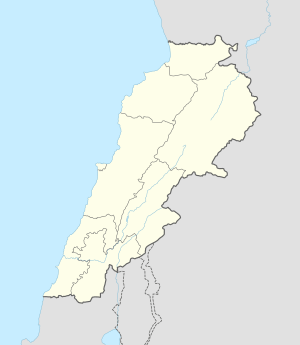  Fardis Location within Lebanon | |
| Coordinates: 33°22′19″N 35°40′04″E / 33.37194°N 35.66778°ECoordinates: 33°22′19″N 35°40′04″E / 33.37194°N 35.66778°E | |
| Grid position | 143/159 L |
| Country |
 Lebanon Lebanon |
| Governorate | Nabatieh Governorate |
| District | Hasbaya District |
| Time zone | EET (UTC+2) |
| • Summer (DST) | EEST (UTC+3) |
| Dialing code | +961 |

Fardis (Arabic: فرديسر) is a small village the Hasbaya District in Lebanon.
History
In 1852 Edward Robinson noted it as a village on the road between Rachaya Al Foukhar and Hasbaya, located directly east of Kaukaba.[1]
In 1988, when the Norbatt part of UNIFIL was stationed there, the village had 500 inhabitants, all Druze.
References
Bibliography
External links
- Fardis, Localiban
Capital: Hasbaya | ||
| Towns and villages | 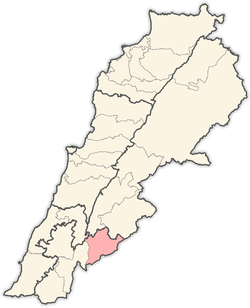 | |
| Other | ||
This article is issued from Wikipedia - version of the 9/20/2016. The text is available under the Creative Commons Attribution/Share Alike but additional terms may apply for the media files.