Gayaza
| Gayaza | |
|---|---|
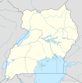  Gayaza Location in Uganda | |
| Coordinates: 00°27′03″N 32°36′42″E / 0.45083°N 32.61167°E | |
| Country |
 Uganda Uganda |
| Region | Central Region |
| District | Wakiso District |
| County | Kyaddondo |
| Constituency | Kyaddondo North |
| Government | |
| • MP | Robert Sebunya Kasule |
| Elevation | 3,900 ft (1,200 m) |
Gayaza is a town in Wakiso District in the Central Region of Uganda.
Location
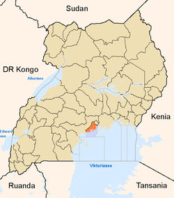
Gayaza is in the North Kyaddondo Constituency, Kyaddondo County. The town is approximately 2.5 kilometres (1.6 mi), north-east of Kasangati,[1] on the road from Kampala, Uganda's capital and largest city, to Ziroobwe, in Luweero District. This is approximately 18.5 kilometres (11 mi), by road, north-east of Kampala.[2] The coordinates of Gayaza are 0°27'03.0"N, 32°36'42.0"E (Latitude:0.450833; Longitude:32.611667).[3]
Overview
In the early 20th century, Gayaza started as a road junction, where the road to Gayaza High School branched off the Kampala-Kalagi highway. Shops began to appear in the middle of the century when the Uganda Ministry of Agriculture opened an agricultural research center at Namulonge. Later, Makerere University opened a crop and animal farm at Kabanyolo to cater for the faculties of Agriculture and Veterinary Medicine. Today, the township continues to grow and is continuous with the Kasangati, a short distance to the south-east.
Points of interest
The following points of interest lie within Gayaza township or close to its borders:
- Gayaza High School - an all-girls' boarding high school established in 1905.
- Gayaza-Ziroobwe Road - a 27 kilometres (17 mi) road that connects Gayaza to Ziroobwe in Luweero District
- National Crops Resources Research Institute at Namulonge - an agricultural research institute belonging to the Ugandan government.[4]
- Makerere University Farm at Kabanyolo - an animal and crop farm belonging to Makerere University
- Kira Farm Training Center - A residential vocational training school situated on 22.5 acres (9.1 ha) of land.
- Gayaza fresh food market
References
- ↑ GFC (26 April 2016). "Distance between Kasangati-Kampala Stage, Gayaza-Kampala Road, Kasangati, Central Region, Uganda and Gayaza, Central Region, Uganda". Globefeed.com (GFC). Retrieved 26 April 2016.
- ↑ GFC (26 April 2016). "Distance between Kampala Road, Kampala, Central Region, Uganda and Gayaza, Central Region, Uganda". Globefeed.com (GFC). Retrieved 26 April 2016.
- ↑ "Location of Gayaza". Retrieved 26 April 2016.
- ↑ Ongu, Isaac (14 November 2014). "Uganda On Track In Agricultural Research". New Vision. Kampala. Retrieved 21 January 2015.
External links
Coordinates: 00°27′03″N 32°36′42″E / 0.45083°N 32.61167°E