Glasgow, Oregon
| Glasgow, Oregon | |
|---|---|
| Census-designated place | |
  Glasgow  Glasgow | |
| Coordinates: 43°26′04″N 124°12′40″W / 43.4345571°N 124.2112245°WCoordinates: 43°26′04″N 124°12′40″W / 43.4345571°N 124.2112245°W | |
| Country | United States |
| State | Oregon |
| County | Coos |
| Area | |
| • Total | 3.22 sq mi (8.35 km2) |
| • Land | 3.22 sq mi (8.35 km2) |
| • Water | 0.0 sq mi (0.0 km2) |
| Elevation | 95[1] ft (29 m) |
| Population (2010) | |
| • Total | 763[2] |
| • Density | 237/sq mi (91.4/km2) |
| Time zone | Pacific (PST) (UTC-8) |
| • Summer (DST) | PDT (UTC-7) |
| FIPS code | 41-29100 |
| GNIS feature ID | 2611732 |
Glasgow is an unincorporated community in Coos County, Oregon, United States.[1] For statistical purposes, the United States Census Bureau has defined Glasgow as a census-designated place (CDP).[3] The census definition of the area may not precisely correspond to local understanding of the area with the same name. As of the 2010 census the Glasgow CDP had a population of 763.[4] The place name for Glasgow in the Coos language is Kdet.[5]
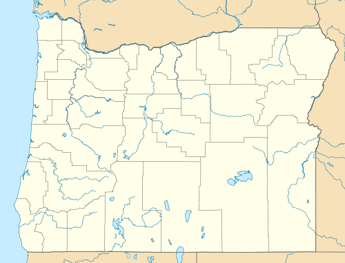
Glasgow is located on the north side of Coos Bay, about 6 miles (10 km) north of the city of Coos Bay, just east of U.S. Route 101.[6][7]
The community was founded by real estate speculators in the 1890s, including Henry L. Pittock, Phil Metschan, and Admiral Schley of the Pacific Coal & Transportation Company.[6] The community did not flourish until 30 years after its founding, when construction of Route 101 made Glasgow the northern terminus of the ferry[8] from North Bend, which was used to cross the bay prior to the completion of the Coos Bay Bridge.[6][9][10] The place was supposedly named by a Scot because it reminded him of Glasgow, Scotland, but the authors of Oregon Geographic Names were unable to verify this.[6]
Glasgow has a store and a Grange hall, the North Bayside Grange, also known as the Glasgow Grange, that was built in 1928.[11][12] A humorous sign at the store states that the community's population is "275.5", the .5 for store owner and "Self-proclaimed mayor", Jack S. Stevens.[13][14][15]
References
- 1 2 "Glasgow". Geographic Names Information System. United States Geological Survey. November 28, 1980. Retrieved April 6, 2014.
- ↑ "American Fact Finder". United States Census Bureau. Retrieved April 6, 2014.
- ↑ "Glasgow Census Designated Place". Geographic Names Information System. United States Geological Survey. April 14, 2010. Retrieved April 6, 2014.
- ↑ "Geographic Identifiers: 2010 Demographic Profile Data (G001): Glasgow CDP, Oregon". U.S. Census Bureau, American Factfinder. Retrieved March 10, 2015.
- ↑ "Hanis for Beginners" (PDF). Confederated Tribes of Coos, Lower Umpqua and Siuslaw Indians. 2001. Retrieved April 6, 2014.
- 1 2 3 4 McArthur, Lewis A.; McArthur, Lewis L. (2003) [1928]. Oregon Geographic Names (7th ed.). Portland, Oregon: Oregon Historical Society Press. p. 404. ISBN 978-0875952772.
- ↑ Oregon Atlas & Gazetteer (7th ed.). Yarmouth, Maine: DeLorme. 2008. p. 51. ISBN 0-89933-347-8.
- ↑ The Roosevelt until 1929, and the Oregon until 1936.
- ↑ "A Selective Chronology of South Coast History: 1900 - Present". Coos Historical & Maritime Museum. Retrieved April 6, 2014.
- ↑ Hull, Lise (2007). Coos County. Images of America. Arcadia Publishing. p. 17. ISBN 0-7385-4803-0.
- ↑ "The Glasgow Gathering is here…". Idyltime. Retrieved April 6, 2014.
- ↑ "Oregon State News of General Interest". The Times. Brownsville, Oregon. August 30, 1928. Retrieved April 6, 2014.
- ↑ "Glasgow, Oregon". Population Signs on Waymarking.com. Waymarking.com. Retrieved April 6, 2014.
- ↑ "Glasgow, Scotland meet Glasgow, Oregon". KCBY. June 8, 2009. Retrieved April 6, 2014.
- ↑ Musicar, Jessica (June 18, 2009). "From Glasgow to Glasgow". The World. Retrieved April 6, 2014.
External links
- Images of Glasgow from Flickr
Municipalities and communities of Coos County, Oregon, United States | ||
|---|---|---|
| Cities | 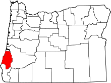 | |
| CDPs | ||
| Unincorporated communities | ||
| Ghost town | ||