Gulf, North Carolina
| Gulf, North Carolina | |
|---|---|
| Census-designated place | |
  Gulf | |
| Coordinates: 35°33′37″N 79°16′54″W / 35.56028°N 79.28167°WCoordinates: 35°33′37″N 79°16′54″W / 35.56028°N 79.28167°W | |
| Country | United States |
| State | North Carolina |
| County | Chatham |
| Area | |
| • Total | 0.92 sq mi (2.39 km2) |
| • Land | 0.91 sq mi (2.36 km2) |
| • Water | 0.01 sq mi (0.03 km2) |
| Elevation | 270 ft (80 m) |
| Population (2010) | |
| • Total | 144 |
| • Density | 158/sq mi (61.1/km2) |
| Time zone | Eastern (EST) (UTC-5) |
| • Summer (DST) | EDT (UTC-4) |
| ZIP code | 27256 |
| FIPS code | 37-28600[1] |
| GNIS feature ID | 1020575[2] |
Gulf is an unincorporated community and census-designated place (CDP) in southwestern Chatham County, North Carolina, United States, southeast of the town of Goldston. As of the 2010 census, the Gulf CDP had a population of 144.[3] The community is home to a general store and several historic homes. It received its name from its location at a wide bend in the Deep River.
Gulf is an interconnection point between the Norfolk Southern Railway and the Aberdeen, Carolina and Western Railway.
Historic sites
The Haughton-McIver House and Marion Jasper Jordan Farm are listed on the National Register of Historic Places.[4]
Geography
Gulf is located on the southern border of Chatham County, on the north side of the Deep River, a tributary of the Cape Fear River. Lee County is to the south, across the Deep River. U.S. Route 421, a four-lane divided highway, passes through the south side of the community; it leads northwest 16 miles (26 km) to Siler City and southeast 8 miles (13 km) to Sanford. Pittsboro, the Chatham County seat, is 17 miles (27 km) to the northeast via the Pittsboro-Goldston Road.
According to the United States Census Bureau, the Gulf CDP has a total area of 0.92 square miles (2.39 km2), of which 0.01 square miles (0.03 km2), or 1.18%, is water.[3]
Gulf is at the geographical center of North Carolina.
References
- ↑ "American FactFinder". United States Census Bureau. Retrieved 2008-01-31.
- ↑ "US Board on Geographic Names". United States Geological Survey. 2007-10-25. Retrieved 2008-01-31.
- 1 2 "Geographic Identifiers: 2010 Demographic Profile Data (G001): Gulf CDP, North Carolina". U.S. Census Bureau, American Factfinder. Retrieved December 30, 2014.
- ↑ National Park Service (2010-07-09). "National Register Information System". National Register of Historic Places. National Park Service.
External links
Municipalities and communities of Chatham County, North Carolina, United States | ||
|---|---|---|
| Towns | 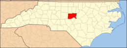 | |
| CDPs | ||
| Unincorporated communities | ||
| Footnotes | ‡This populated place also has portions in an adjacent county or counties | |