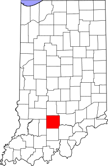
Guthrie Township, Lawrence County, Indiana
| Guthrie Township | |
|---|---|
| Township | |
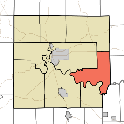 Location in Lawrence County | |
| Coordinates: 38°48′38″N 86°20′14″W / 38.81056°N 86.33722°WCoordinates: 38°48′38″N 86°20′14″W / 38.81056°N 86.33722°W | |
| Country |
 United States United States |
| State |
 Indiana Indiana |
| County | Lawrence |
| Government | |
| • Type | Indiana township |
| Area | |
| • Total | 42.79 sq mi (110.8 km2) |
| • Land | 42.19 sq mi (109.3 km2) |
| • Water | 0.6 sq mi (2 km2) 1.40% |
| Elevation | 728 ft (222 m) |
| Population (2010) | |
| • Total | 1,383 |
| • Density | 32.8/sq mi (12.7/km2) |
| ZIP codes | 47264, 47421, 47430, 47467 |
| GNIS feature ID | 0453359 |
Guthrie Township is one of nine townships in Lawrence County, Indiana, United States.[1] As of the 2010 census, its population was 1,383 and it contained 654 housing units.[2][3]
History
Guthrie Township was established in the early 1860s.[4] Guthrie was the surname of a family of pioneer settlers.[5]
The Clampitt Site was listed in the National Register of Historic Places in 2016.[6]
Geography
According to the 2010 census, the township has a total area of 42.79 square miles (110.8 km2), of which 42.19 square miles (109.3 km2) (or 98.60%) is land and 0.6 square miles (1.6 km2) (or 1.40%) is water.[2] The township's southern border is defined by the East Fork White River.
Unincorporated towns
- Buddha at 38°47′31″N 86°24′24″W / 38.791997°N 86.406656°W
- Fort Ritner at 38°46′23″N 86°16′52″W / 38.773109°N 86.281096°W
- Leesville at 38°50′44″N 86°17′04″W / 38.845608°N 86.284431°W
- Pinhook at 38°48′55″N 86°21′23″W / 38.815330°N 86.356377°W
- Tunnelton at 38°46′07″N 86°20′34″W / 38.768664°N 86.342765°W
(This list is based on USGS data and may include former settlements.)[1]
Cemeteries
The township contains these cemeteries: Carlton, Dodd, Johnston, and Pinhook.
School districts
- North Lawrence Community Schools
Political districts
- Indiana's 4th congressional district
- State House District 65
- State Senate District 44
Organizations
- Guthrie Township Volunteer Fire Department
References
- 1 2 "Guthrie Township, Lawrence County, Indiana". Geographic Names Information System. United States Geological Survey. Retrieved 2009-10-08.
- 1 2 "Population, Housing Units, Area, and Density: 2010 - County -- County Subdivision and Place -- 2010 Census Summary File 1". United States Census. Retrieved 2013-05-10.
- ↑ United States Census Bureau American FactFinder
- ↑ History of Lawrence and Monroe Counties, Indiana: Their People, Industries, and Institutions. B.F. Bowen. 1914. p. 44.
- ↑ History of Lawrence, Orange, and Washington Counties, Indiana: From the Earliest Time to the Present. Higginson Book Company. 1884. p. 62.
- ↑ "National Register of Historic Places Listings". Weekly List of Actions Taken on Properties: 3/14/16 through 3/18/16. National Park Service. 2016-03-25.
External links
- Indiana Township Association
- United Township Association of Indiana
- City-Data.com page for Guthrie Township
 |
Shawswick Township | Pleasant Run Township | Owen Township, Jackson County | |
| Marion Township |  |
Carr Township, Jackson County | ||
| ||||
 | ||||
| Bono Township | Brown Township, Washington County |