Gyobin
| Gyobin | |
|---|---|
| Town | |
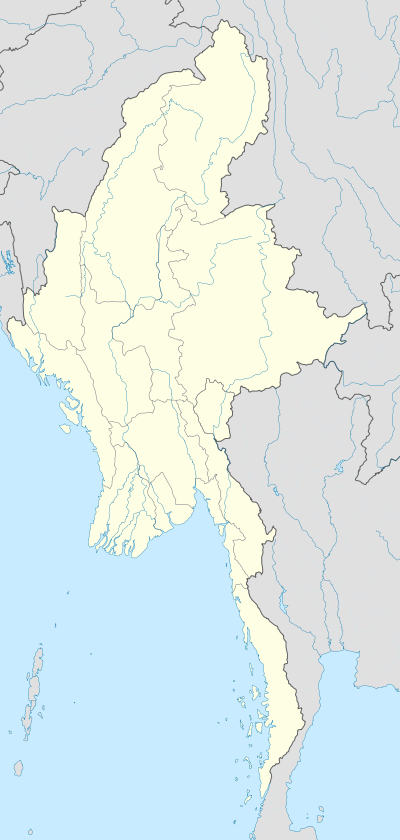  Gyobin Location in Burma | |
| Coordinates: 24°50′N 95°18′E / 24.833°N 95.300°ECoordinates: 24°50′N 95°18′E / 24.833°N 95.300°E | |
| Country |
 Burma Burma |
| Region | Sagaing Region |
| District | Hkamti District |
| Township | Homalin Township |
| Time zone | MST (UTC+6.30) |
Gyobin is a river town in Homalin Township, Hkamti District, in the Sagaing Region of northwestern Burma. It is located east of Kaukngo.[1][2]An old frontier outpost was located at Gyobin during the British Burma period.[3]
References
- ↑ Google Maps (Map). Google.
- ↑ Bing Maps (Map). Microsoft and Harris Corporation Earthstar Geographics LLC.
- ↑ "Routes in Upper Burma, Including the Chin Hills and Shan States, to which are Added a Number of Routes Leading from Lower Burma and Siam Into Those Districts, A. B. Fenton". India. Army. Madras Army. Quartermaster-General's Office, Cultural Pub. House,. 1983. p. 1043.
External links

This article is issued from Wikipedia - version of the 11/6/2016. The text is available under the Creative Commons Attribution/Share Alike but additional terms may apply for the media files.