Havana, Oregon
| Havana, Oregon | |
|---|---|
| Unincorporated community | |
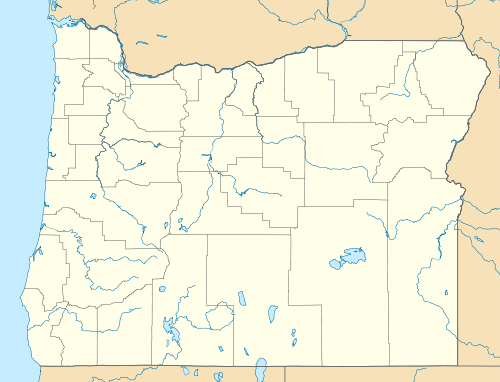  Havana, Oregon Location within the state of Oregon | |
| Coordinates: 45°43′29″N 118°39′25″W / 45.72472°N 118.65694°WCoordinates: 45°43′29″N 118°39′25″W / 45.72472°N 118.65694°W | |
| Country | United States |
| State | Oregon |
| County | Umatilla |
| Elevation | 1,312 ft (400 m) |
| Time zone | Pacific (PST) (UTC-8) |
| • Summer (DST) | PDT (UTC-7) |
| Area code(s) | 458 and 541 |
| GNIS feature ID | 1136364[1] |
| Coordinates and elevation from Geographic Names Information System[1] | |
Havana is an unincorporated community[1] in Umatilla County, Oregon, United States, 9 miles (14 km) northeast of Pendleton on Wildhorse Creek. This Union Pacific Railroad station[2] is near the junction of Oregon Route 335—known as the Havana–Helix Highway—with Oregon Route 11, about 9 miles south of Helix. Its elevation is 1312 feet (400 m).[1]
References
- 1 2 3 4 "Havana". Geographic Names Information System. United States Geological Survey. November 28, 1980. Retrieved September 9, 2016.
- ↑ "The Idea of National Highways". Motoring Magazine and Motoring Life. Oct–Dec 1913. Retrieved December 21, 2009.
External links
- 1950s images of the McCormmach Ranch in the Havana area from Oregon State University Extension Service, Umatilla County
Municipalities and communities of Umatilla County, Oregon, United States | ||
|---|---|---|
| Cities |  | |
| CDPs | ||
| Other unincorporated communities | ||
| Indian reservation | ||
| Ghost towns | ||
This article is issued from Wikipedia - version of the 9/10/2016. The text is available under the Creative Commons Attribution/Share Alike but additional terms may apply for the media files.