Hickory Hills, Pennsylvania
| Hickory Hills, Pennsylvania | |
|---|---|
| Census-designated place | |
  Hickory Hills Location within the state of Pennsylvania | |
| Coordinates: 41°2′3″N 75°49′14″W / 41.03417°N 75.82056°WCoordinates: 41°2′3″N 75°49′14″W / 41.03417°N 75.82056°W | |
| Country | United States |
| State | Pennsylvania |
| County | Luzerne |
| Township | Foster Township |
| Area | |
| • Total | 1.41 sq mi (3.66 km2) |
| • Land | 1.40 sq mi (3.63 km2) |
| • Water | 0.008 sq mi (0.02 km2) |
| Population (2010) | |
| • Total | 562 |
| • Density | 400/sq mi (150/km2) |
| Time zone | Eastern (EST) (UTC-5) |
| • Summer (DST) | EDT (UTC-4) |
| ZIP code | 18661 |
| Area code(s) | 570 and 272 |
Hickory Hills is a census-designated place (CDP) in Foster Township, Luzerne County, Pennsylvania, United States, southwest of the borough of White Haven. The CDP population was 562 at the 2010 census.[1]
Geography
Hickory Hills is located at 41°2′3″N 75°49′14″W / 41.03417°N 75.82056°W.[2]
According to the United States Census Bureau, the CDP has a total area of 1.4 square miles (3.7 km2), of which 1.4 square miles (3.6 km2) is land and 0.008 square miles (0.02 km2), or 0.57%, is water.[3] Pennsylvania Route 940 forms the northern edge of the CDP, connecting it with White Haven to the northeast and Freeland to the southwest.
References
- ↑ "Profile of General Population and Housing Characteristics: 2010 Demographic Profile Data (DP-1): Hickory Hills CDP, Pennsylvania". U.S. Census Bureau, American Factfinder. Retrieved April 25, 2012.
- ↑ "US Gazetteer files: 2010, 2000, and 1990". United States Census Bureau. 2011-02-12. Retrieved 2011-04-23.
- ↑ "Geographic Identifiers: 2010 Demographic Profile Data (G001): Hickory Hills CDP, Pennsylvania". U.S. Census Bureau, American Factfinder. Retrieved April 25, 2012.
Municipalities and communities of Luzerne County, Pennsylvania, United States | ||
|---|---|---|
| Cities | 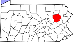 | |
| Boroughs |
| |
| Townships | ||
| CDPs | ||
| Unincorporated communities |
| |
| Footnotes | ‡This populated place also has portions in an adjacent county or counties | |
This article is issued from Wikipedia - version of the 1/21/2016. The text is available under the Creative Commons Attribution/Share Alike but additional terms may apply for the media files.