Ikaruga, Nara
| Ikaruga 斑鳩町 | ||
|---|---|---|
| Town | ||
| ||
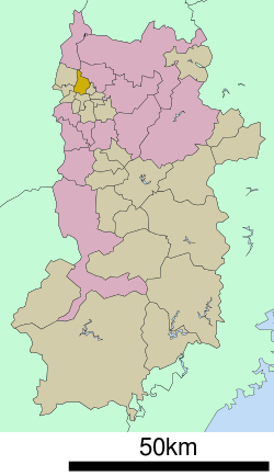 Location of Ikaruga in Nara Prefecture | ||
  Ikaruga Location in Japan | ||
| Coordinates: 34°37′N 135°44′E / 34.617°N 135.733°ECoordinates: 34°37′N 135°44′E / 34.617°N 135.733°E | ||
| Country | Japan | |
| Region | Kansai | |
| Prefecture | Nara Prefecture | |
| District | Ikoma | |
| Area | ||
| • Total | 14.27 km2 (5.51 sq mi) | |
| Population (April 1, 2015) | ||
| • Total | 27,341 | |
| • Density | 1,900/km2 (5,000/sq mi) | |
| Symbols | ||
| • Tree | Japanese Black Pine | |
| • Flower | Camellia sasanqua | |
| Time zone | Japan Standard Time (UTC+9) | |
| City hall address |
3-7-12 Hōryūjinishi, Ikaruga-cho, 630-8580 | |
| Website |
www | |
Ikaruga (斑鳩町 Ikaruga-chō) is a town in Ikoma District, Nara, Japan.
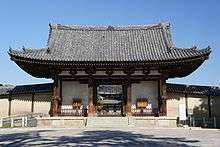
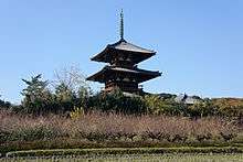
Ikaruga is home to Hōryū-ji and Hokki-ji, ancient Buddhist temples collectively inscribed as UNESCO World Heritage. Other ancient temples include Hōrin-ji, also in the vicinity of Hōryū-ji. The town was named after the Palace of Prince Shōtoku-Taishi, Ikaruga-no-Miya (Imperial Palace of Ikaruga, or Imperial House of Ikaruga), whose grounds were at Hōryū-ji, thus it is also called Ikaruga-dera (temple of Ikaruga).
As of April 1, 2015, the town has an estimated population of 27,341, with 11,308 households.[1] The total area is 14.27 km2 (6 sq mi).
Neighboring municipalities
Geography
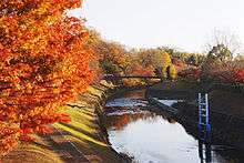
- Tatsuta River (Nara Prefectural Tatsuta Park)
- Yamato River
- Mount Matsuo
Education
Elementary schools
- Ikaruga Elementary School
- Ikarugahigashi Elementary School
- Ikaruganishi Elementary School
Junior high schools
- Ikaruga Junior High School
- Ikarugaminami Junior High School
High schools
- Hōryū-ji International High School
Notable places
Temples and shrines
Kofun
- Fujinoki Kofun
- Kasuga Kofun
- Okanohara Kofun
- Terayama Kofun
Transportation
Rail
Road


References
- ↑ "市町村別推計人口・世帯数". Nara Prefecture. April 1, 2015. Retrieved May 5, 2015.
External links
 |
Wikimedia Commons has media related to Ikaruga, Nara. |
- Official website (Japanese)
| Core city |  | |
|---|---|---|
| Cities | ||
| Ikoma District | ||
| Kitakatsuragi District | ||
| Shiki District | ||
| Takaichi District | ||
| Uda District | ||
| Yamabe District | ||
| Yoshino District | ||

This article is issued from Wikipedia - version of the 11/6/2015. The text is available under the Creative Commons Attribution/Share Alike but additional terms may apply for the media files.