Jefferson Historic District (Lafayette, Indiana)
|
Jefferson Historic District | |
|
Jefferson Historic District, November 2009 | |
    | |
| Location | Roughly bounded by 9th, Erie, Elizabeth, and Ferry Sts., Lafayette, Indiana |
|---|---|
| Coordinates | 40°25′19″N 86°53′04″W / 40.42194°N 86.88444°WCoordinates: 40°25′19″N 86°53′04″W / 40.42194°N 86.88444°W |
| Area | 22 acres (8.9 ha) |
| Architect | Scholer, Walter A. |
| Architectural style | Greek Revival, Italianate, et al. |
| NRHP Reference # | 01000976[1] |
| Added to NRHP | September 16, 2001 |
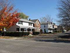
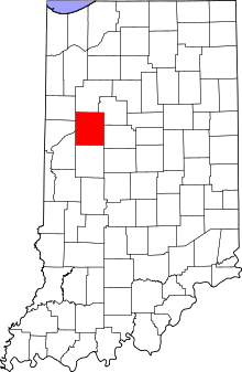
Jefferson Historic District is a national historic district located at Lafayette, Tippecanoe County, Indiana. The district encompasses 161 contributing buildings, 2 contributing sites, and 22 contributing structures in a predominantly residential section of Lafayette. It developed between about 1853 and 1951 and includes representative examples of Italianate, Greek Revival, and Bungalow / American Craftsman style architecture. Notable contributing resources include the Deutsche Evangelische Kirche (1905), Isador Metzger House (c. 1866), Hubert Gilmartin House (c. 1868), B.F. Biggs Pump Factory Building (1872, 1885-1894), Deutsche Methodist Kirche (1885), Herman & Mary Fletemeyer House (c. 1897), Mohr House (c. 1865), Warrenberg-Reule Double House (c. 1878), Alfred Gaddis House (c. 1865), Wabash Valley House (1862), Haywood Tag Company Building (1928), and Jefferson High School (1927).[2]
It was listed on the National Register of Historic Places in 2001.[1]
See also
- Centennial Neighborhood District
- Downtown Lafayette Historic District
- Ellsworth Historic District
- Highland Park Neighborhood Historic District
- Ninth Street Hill Historic District
- Park Mary Historic District
- Perrin Historic District
- St. Mary Historic District
- Upper Main Street Historic District
References
- 1 2 National Park Service (2010-07-09). "National Register Information System". National Register of Historic Places. National Park Service.
- ↑ "Indiana State Historic Architectural and Archaeological Research Database (SHAARD)" (Searchable database). Department of Natural Resources, Division of Historic Preservation and Archaeology. Retrieved 2016-07-01. Note: This includes Angela Bowen (March 2001). "National Register of Historic Places Inventory Nomination Form: Jefferson Historic District" (PDF). Retrieved 2016-07-01., Site map, and Accompanying photographs