Khandpara State
| Khandpara State ଖଣ୍ଡପଡ଼ା / खंड्पारा | |||||
| Princely State of British India | |||||
| |||||
|
Flag | |||||
 | |||||
| History | |||||
| • | Established | c. 1599 | |||
| • | Accession to the Union of India | 1948 | |||
| Area | |||||
| • | 1901 | 632 km2 (244 sq mi) | |||
| Population | |||||
| • | 1901 | 77,929 | |||
| Density | 123.3 /km2 (319.4 /sq mi) | ||||
 This article incorporates text from a publication now in the public domain: Chisholm, Hugh, ed. (1911). "article name needed". Encyclopædia Britannica (11th ed.). Cambridge University Press. This article incorporates text from a publication now in the public domain: Chisholm, Hugh, ed. (1911). "article name needed". Encyclopædia Britannica (11th ed.). Cambridge University Press. | |||||


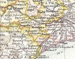
Khandpara State (Odia: ଖଣ୍ଡପଡ଼ା; Hindi: खंड्पारा) was one of the princely states of India during the period of the British Raj. It was located in present-day Nayagarh district, Odisha.
The state was bounded in the north by the Mahanadi River. The main town was Kantilo, but the capital was at Khandpara (Khandapada).[1]
History
Khandpara State was initially part of Nayagarh State, founded by a former ruler of Rewa State, but became a separate kingdom in 1599 when Jadunath Singh Mangraj, the first ruler of Khandpara received the title of 'Mangraj' from the Maharaja of Orissa.[2] The rulers were Rajputs of the Baghela or Vaghela dynasty. The last Raja of Khandpara signed the instrument of accession to the Indian Union on 1 January 1948.[3]
Rulers
The rulers of Khandpara State bore the title of Raja. The emblem of the Khandpara royal family was the head of a tiger; state symbols were identical in neighboring Nayagarh State.[4]
Rajas
- 1599 - 1675 Jadunath Singh Mangraj, 1st Raja of Khandpara
- 1675 - 1709 Narayan Singh Mangraj
- 1709 - 1723 Balunkeshwar Singh Mangraj
- 1723 - 1732 Banamali Singh Mardraj Bhramarbar Rai
- 1734 - 1770 Bairagi Singh Mardraj Bhramarbar Rai
- 1770 - 1794 Niladri Singh Mardraj Bhramarbar Rai
- 1794 - 1815 Narasimha Singh Mardraj Bhramarbar Rai
- 1815 - 1821 Purushottam Mardraj Bhramarbar Rai
- 1821 - 1842 Krishna Chandra Singh Bhramarbar Rai
- 1842 - 1867 Kunja Bihari Singh Bhramarbar Rai
- 28 Feb 1867 - 1905 Natobar Mardraj Bhramarbar Rai (b. 1837 - d. 1905)
- 1905 - 26 Dec 1922 Ram Chandra Singh Mardraj Bhramarbar Rai
- 26 Dec 1922 – 15 Aug 1947 Harihar Singh Deo Mardraj Bhramarbar Rai (b. 1914 - d. 1977)
See also
References
- ↑ Great Britain India Office. The Imperial Gazetteer of India. Oxford: Clarendon Press, 1908.
- ↑ Khandpara (Princely State)
- ↑ Rajput Provinces of India - Khandpara (Princely State)
- ↑ Princely States of India
Coordinates: 20°15′50″N 85°12′51″E / 20.26389°N 85.21417°E