Klipplaat
| Klipplaat | |
|---|---|
|
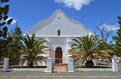
Dutch Reformed Church in Klipplaat | |
  Klipplaat  Klipplaat  Klipplaat
| |
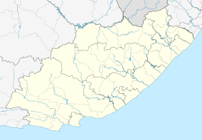
| Coordinates: 33°01′05″S 24°20′24″E / 33.018°S 24.340°ECoordinates: 33°01′05″S 24°20′24″E / 33.018°S 24.340°E | |
| Country | South Africa |
| Province | Eastern Cape |
| District | Sarah Baartman |
| Municipality | Dr Beyers Naudé |
| Area[1] | |
| • Total | 12.9 km2 (5.0 sq mi) |
| Population (2011)[1] | |
| • Total | 2,967 |
| • Density | 230/km2 (600/sq mi) |
| Racial makeup (2011)[1] | |
| • Black African | 36.7% |
| • Coloured | 61.3% |
| • Indian/Asian | 0.4% |
| • White | 1.1% |
| • Other | 0.6% |
| First languages (2011)[1] | |
| • Afrikaans | 67.7% |
| • Xhosa | 27.3% |
| • English | 2.5% |
| • Other | 2.5% |
| Postal code (street) | 6255 |
| PO box | 6255 |
| Area code | 049 |
Klipplaat is a town in Sarah Baartman District Municipality in the Eastern Cape province of South Africa.
The town is some 185 km north-west of Port Elizabeth and 75 km south-east of Aberdeen.[2] It takes its name from large slabs of rock on the surface of the ground; from Afrikaans klip: 'stone' or 'rock'; plaat: 'sheet' or 'slab'.[3]
References
- 1 2 3 4 Sum of the Main Places Klipplaat and Wongalethu from Census 2011.
- ↑ Travel distances from Klipplaat
- ↑ "Dictionary of Southern African Place Names (Public Domain)". Human Science Research Council. p. 251.
Municipalities and communities of Sarah Baartman District Municipality, Eastern Cape | ||
|---|---|---|
District seat: Port Elizabeth | ||
| Blue Crane Route | .svg.png) | |
| Dr Beyers Naudé | ||
| Kouga | ||
| Kou-Kamma | ||
| Makana | ||
| Ndlambe | ||
| Sunday's River Valley | ||
This article is issued from Wikipedia - version of the 9/5/2016. The text is available under the Creative Commons Attribution/Share Alike but additional terms may apply for the media files.