Louterwater
| Louterwater | |
|---|---|
  Louterwater  Louterwater  Louterwater
| |
| Coordinates: 33°48′S 23°40′E / 33.8°S 23.67°ECoordinates: 33°48′S 23°40′E / 33.8°S 23.67°E | |
| Country | South Africa |
| Province | Eastern Cape |
| District | Sarah Baartman |
| Municipality | Kou-Kamma |
| Area[1] | |
| • Total | 1.99 km2 (0.77 sq mi) |
| Population (2011)[1] | |
| • Total | 4,829 |
| • Density | 2,400/km2 (6,300/sq mi) |
| Racial makeup (2011)[1] | |
| • Black African | 27.4% |
| • Coloured | 70.3% |
| • Indian/Asian | 0.1% |
| • White | 1.0% |
| • Other | 1.1% |
| First languages (2011)[1] | |
| • Afrikaans | 74.2% |
| • Xhosa | 21.2% |
| • English | 1.7% |
| • Other | 2.8% |
| PO box | 6435 |
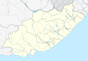
Louterwater is a town in Sarah Baartman District Municipality in the Eastern Cape province of South Africa, located between Joubertina and Misgund on the R62 road.[2]
The town hosts a large apple and pear farm of the same name, which had been bought in 1961 by P. K. Le Roux, then Minister of Agriculture and Water Affairs; the farm is still owned by his descendants.[3]
References
- 1 2 3 4 "Main Place Louterwater". Census 2011.
- ↑ "Louterwater Estate". Louterwater Estate. Retrieved 29 August 2014.
- ↑ "History of Louterwater Estate". Louterwater Estate. Retrieved 29 August 2014.
Municipalities and communities of Sarah Baartman District Municipality, Eastern Cape | ||
|---|---|---|
District seat: Port Elizabeth | ||
| Blue Crane Route | .svg.png) | |
| Dr Beyers Naudé | ||
| Kouga | ||
| Kou-Kamma | ||
| Makana | ||
| Ndlambe | ||
| Sunday's River Valley | ||
This article is issued from Wikipedia - version of the 11/22/2015. The text is available under the Creative Commons Attribution/Share Alike but additional terms may apply for the media files.