Kostelní Lhota
| Kostelní Lhota | |||
|---|---|---|---|
| Municipality and village | |||
 | |||
| |||
| Country |
 Czech Republic Czech Republic | ||
| Region | Central Bohemian Region | ||
| District | Nymburk District | ||
| Area | |||
| • Total | 3.34 sq mi (8.66 km2) | ||
| Elevation | 614 ft (187 m) | ||
| Population (2011) | |||
| • Total | 813 | ||
| • Density | 240/sq mi (94/km2) | ||
| Time zone | CET (UTC+1) | ||
| • Summer (DST) | CEST (UTC+2) | ||
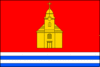
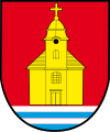
Kostelní Lhota is a village and municipality in Nymburk District in the Central Bohemian Region of the Czech Republic.
References
- This article was initially translated from the Czech Wikipedia.
Coordinates: 50°08′N 15°02′E / 50.133°N 15.033°E
 |
Wikimedia Commons has media related to Kostelní Lhota. |
This article is issued from Wikipedia - version of the 4/7/2016. The text is available under the Creative Commons Attribution/Share Alike but additional terms may apply for the media files.