Makara, New Zealand
| Makara | |
|---|---|
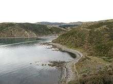 Makara beach | |
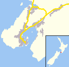  Makara | |
| Basic information | |
| Local authority | Wellington |
| Coordinates | 41°16′09″S 174°42′18″E / 41.269120°S 174.705122°ECoordinates: 41°16′09″S 174°42′18″E / 41.269120°S 174.705122°E |
| Population | 759 (2006) |
| Surrounds | |
| North | Ohariu |
| East | Karori, Owhiro Bay |
Makara is a locality located at the western edge of Wellington, New Zealand, close to the shore of the Tasman Sea.[1]
With winding road access from Karori or Johnsonville / Ohariu, Makara is a rural area with sparse development.
In the nineteenth century there was a small amount of gold-mining but no large-scale workable deposits were ever found.
Adjacent to Cape Terawhiti the Cook Strait cables come ashore, carrying power and telecommunications between the North and South Islands.
See also
- Project West Wind wind farm.
- Terawhiti Station.
References
- ↑ "Place Name Detail: Makara". New Zealand Geographic Placenames Database. Land Information New Zealand. Retrieved 2010-05-06.
External links
 |
Wikimedia Commons has media related to Makara, New Zealand. |
This article is issued from Wikipedia - version of the 11/28/2016. The text is available under the Creative Commons Attribution/Share Alike but additional terms may apply for the media files.