McAdams, Pennsylvania
| McAdams, Pennsylvania | |
|---|---|
| Unincorporated community | |
  McAdams, Pennsylvania | |
| Coordinates: 40°23′10″N 80°16′04″W / 40.38611°N 80.26778°WCoordinates: 40°23′10″N 80°16′04″W / 40.38611°N 80.26778°W | |
| Country | United States |
| State | Pennsylvania |
| County | Washington |
| Elevation | 1,106 ft (337 m) |
| Time zone | Eastern (EST) (UTC-5) |
| • Summer (DST) | EDT (UTC-4) |
| Area code(s) | 724 |
| GNIS feature ID | 1198230[1] |
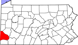
McAdams (also known as Montour No. 9) is an unincorporated community in Robinson Township, Washington County, Pennsylvania, United States.[1] McAdams is located at the intersection of Pennsylvania Route 980 and North Branch Road 2.2 miles (3.5 km) west-northwest of McDonald.[2] The community is a coal town which was the site of the Pittsburgh Coal Company's Montour No. 9 mine, which closed in 1954. The Montour Trail passes through the community, as did a branch of the Montour Railroad during the mine's operation.[3]
References
- 1 2 "McAdams". Geographic Names Information System. United States Geological Survey.
- ↑ Washington County, Pennsylvania General Highway Map (PDF) (Map). Pennsylvania Department of Transportation. 2012. Retrieved November 1, 2012.
- ↑ Ciminel, Bob (November–December 2010). "Montour No. 9 Mine, McAdams, PA" (PDF). Montour Trail-Letter. Montour Trail Council. 21 (6). Retrieved November 1, 2012.
| Counties | 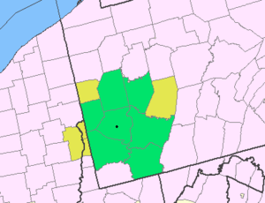 Map of the Pittsburgh Tri-State with green counties in the metropolitan area and yellow counties in the combined area. | |
|---|---|---|
| Major cities | ||
| Cities and towns 15k-50k (in 2010) | ||
| Airports | ||
| Topics | ||
| ||


This article is issued from Wikipedia - version of the 9/5/2016. The text is available under the Creative Commons Attribution/Share Alike but additional terms may apply for the media files.