Melandra, Cyprus
For the castle of the same name in Derbyshire, England, see Ardotalia.
| Melandra Μελάνδρα | |
|---|---|
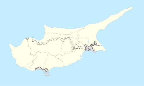  Melandra Location in Cyprus | |
| Coordinates: 34°59′21″N 32°31′30″E / 34.98917°N 32.52500°ECoordinates: 34°59′21″N 32°31′30″E / 34.98917°N 32.52500°E | |
| Country |
 Cyprus Cyprus |
| District | Paphos District |
| Population (2001)[1] | |
| • Total | 0 |
| Time zone | EET (UTC+2) |
| • Summer (DST) | EEST (UTC+3) |
| Postal code | 6319 |
Melandra (Greek: Μελάνδρα, also spelled Μελάντρα, Turkish: Beşiktepe) is an abandoned Turkish Cypriot village in the Paphos District of Cyprus, located 2 kilometres (1.2 mi) southeast of Lysos. Prior to 1974, the village was inhabited by Turkish Cypriots.[2] The village is completely destroyed, apparently by shelling. The only two buildings that were not touched are the mosque and the orthodox chapel.
References
- ↑ Census 2001
- ↑ "Archived copy". Archived from the original on October 28, 2007. Retrieved June 14, 2009.


This article is issued from Wikipedia - version of the 12/2/2016. The text is available under the Creative Commons Attribution/Share Alike but additional terms may apply for the media files.