Melindwr
| Melindwr | |
 |
|
  Melindwr |
|
| Population | 1,038 |
|---|---|
| OS grid reference | SN67NE59 |
| – Cardiff | 71.6 mi (115.2 km) |
| – London | 173.8 mi (279.7 km) |
| Community | Melindwr |
| Principal area | Ceredigion |
| Country | Wales |
| Sovereign state | United Kingdom |
| Post town | Aberystwyth |
| Postcode district | SY23 |
| Police | Dyfed-Powys |
| Fire | Mid and West Wales |
| Ambulance | Welsh |
| EU Parliament | Wales |
|
|
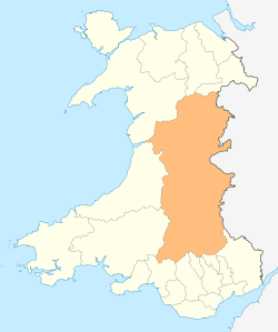
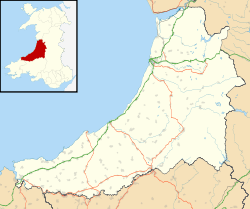
Coordinates: 52°24′04″N 3°56′38″W / 52.401107°N 3.943803°WMelindwr is a community in the county of Ceredigion, Wales, and is 71.6 miles (115.1 km) from Cardiff and 173.8 miles (279.7 km) from London.[1][2] In 2011 the population of Melindwr was 1038 with 54.7% of them able to speak Welsh.
Villages within this community include: Pisgah, Cwmbrwyno, Pant-y-crug, Maes-bangor, Dollwen, Dol-y-pandy, Blaen-geuffordd and Pen-llwyn.
Buwch a'r Llo Standing Stones (litr. "Cow and Calf") is a standing stone within the community; 52.4329°N 3.8815°W. Goginan mine, is a pre-Roan (Celtic) lead and zinc mine which is also situated in Melindwr community.[4]
Governance
An electoral ward in the same name exists. This stretches beyond the confines of Melindwr Community. The total population at the 2011 Census was 2020.[5]
References
- ↑ Bangor University Placenames Unit (Canolfan Bedwyr); accessed 9 May 2014
- ↑ Google Maps (Map). Google.
- ↑ Welsh Government website; 2011 Census Returns and stats; accessed 9 May 2014
- ↑ http://www.mindat.org/ website; accessed 10 May 2014.
- ↑ "Ward population 2011". Retrieved 13 May 2015.