Melmore, Ohio
| Melmore, Ohio | |
|---|---|
| census-designated place | |
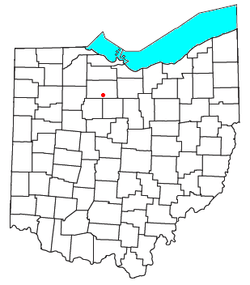 Location of Melmore, Ohio | |
| Coordinates: 41°01′26″N 83°06′34″W / 41.02389°N 83.10944°WCoordinates: 41°01′26″N 83°06′34″W / 41.02389°N 83.10944°W | |
| Country | United States |
| State | Ohio |
| County | Seneca |
| Township | Eden |
| Time zone | Eastern (EST) (UTC-5) |
| • Summer (DST) | EDT (UTC-4) |
| ZIP codes | 44845 |
Melmore is a census-designated place in central Eden Township, Seneca County, Ohio, United States.[1] Although it is unincorporated, it has a post office, with the ZIP code of 44845.[2] It is located at the intersection of State Routes 67 and 100.
History
Melmore was platted in 1824.[3] The name Melmore was formed from the Latin mel, meaning "honey", and the adjective -more; honey standing for Honey Creek, upon which the town is situated.[4] A post office was established at Melmore in 1825, and remained in operation until 1993.[5]
References
- ↑ U.S. Geological Survey Geographic Names Information System: Melmore, Ohio
- ↑ Zip Code Lookup
- ↑ Lang, William (1880). History of Seneca County, from the Close of the Revolutionary War to July, 1880. Transcript Printing Company. p. 525.
- ↑ Butterfield, Consul Willshire (1848). History of Seneca County: Containing a Detailed Narrative of the Principal Events that Have Occurred Since Its First Settlement Down to the Present Time. D. Campbell. p. 102.
- ↑ "Seneca County". Jim Forte Postal History. Retrieved 27 December 2015.
Municipalities and communities of Seneca County, Ohio, United States | ||
|---|---|---|
| Cities | 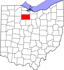 | |
| Villages | ||
| Townships | ||
| CDPs | ||
| Unincorporated communities | ||
| Ghost towns | ||
| Footnotes | ‡This populated place also has portions in an adjacent county or counties | |
This article is issued from Wikipedia - version of the 10/23/2016. The text is available under the Creative Commons Attribution/Share Alike but additional terms may apply for the media files.