Mississippi Highway 25
| ||||
|---|---|---|---|---|
| Route information | ||||
| Maintained by MDOT | ||||
| Length: | 221.142 mi[1] (355.894 km) | |||
| Major junctions | ||||
| South end: |
  I-55 / US 51 in Jackson I-55 / US 51 in Jackson | |||
 US 82 in Starkville US 82 in Starkville  US 45 Alt. in West Point US 45 in Aberdeen US 45 Alt. in West Point US 45 in Aberdeen US 278 in Amory US 278 in Amory  I-22 / US 78 in Fulton I-22 / US 78 in Fulton US 72 in Iuka US 72 in Iuka | ||||
| North end: |
 SR 57 near North Crossroads SR 57 near North Crossroads | |||
| Highway system | ||||
| ||||


.jpg)
Mississippi Highway 25 runs from I-55 in Jackson, Mississippi to the Tennessee state line north of Iuka. The largely controlled-access part from Jackson to Starkville connects the state capital with the main campus of Mississippi State University.
History
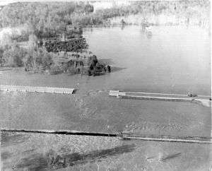
As of June 28, 2006, 150 miles (240 km) of continuous four-lane divided highway is open between Starkville, Mississippi, and Jackson, Mississippi. The last leg to open was the 11.9-mile (19.2 km), $27-million section from the intersection of Highway 19 north of Louisville, Mississippi, to Noxapater Creek in Winston County. This is one of the culminations of the 1987 Four-Lane Highway Program (commonly referred to as AHEAD Program) for improving Mississippi roadways.
On May 10, 2006 the next-to-last leg, a 10.1-mile (16.3 km), $23-million section, opened from the Oktibbeha County line west into Winston County.
Future
All of Highway 25, except for the portion between West Point, Mississippi, and Fulton, Mississippi, will be an at least four-lane divided highway by the mid-2010s, per Mississippi House Bill 725 of the 1998 session.
Cities on the route
From south to north
- Jackson, Mississippi
- Flowood, Mississippi
- Carthage, Mississippi
- Louisville, Mississippi
- Starkville, Mississippi
- West Point, Mississippi
- Aberdeen, Mississippi
- Amory, Mississippi
- Smithville, Mississippi
- Fulton, Mississippi
- Belmont, Mississippi
- Tishomingo, Mississippi
- Iuka, Mississippi
Major intersections
| County | Location | mi | km | Destinations | Notes |
|---|---|---|---|---|---|
| Hinds | Jackson | I-55 / Lakeland Drive west – McComb, Grenada | I-55 exit 98B | ||
| Rankin | Flowood | Treetops Boulevard | proposed MS 477 | ||
  MS 475 south to I-20 – USPFO, International Airport MS 475 south to I-20 – USPFO, International Airport | |||||
| |  MS 471 south – Brandon MS 471 south – Brandon | interchange; south end of MS 471 overlap | |||
| | MS 471 north – Goshen Springs | interchange; north end of MS 471 overlap | |||
| Koch |  MS 43 – Canton, Sand Hill, Rankin County, Sandhill MS 43 – Canton, Sand Hill, Rankin County, Sandhill | interchange | |||
| Leake | |  To MS 483 – Leake County Water Park, Ludlow, Ross Barnett Reservoir Low Head Dam To MS 483 – Leake County Water Park, Ludlow, Ross Barnett Reservoir Low Head Dam | |||
| |  MS 13 south – Lena, Morton MS 13 south – Lena, Morton | ||||
| Wiggins |  MS 16 – Canton, Carthage MS 16 – Canton, Carthage | interchange | |||
| |  To MS 429 – Thomastown To MS 429 – Thomastown | ||||
| Carthage |  MS 35 – Kosciusko, Carthage MS 35 – Kosciusko, Carthage | interchange | |||
| | Remus Road | proposed MS 427 | |||
| Winston | Four Corners |  MS 19 – Kosciusko, Philadelphia MS 19 – Kosciusko, Philadelphia | interchange | ||
| Louisville |  MS 15 south – Philadelphia MS 15 south – Philadelphia | interchange; south end of MS 15 overlap | |||
 MS 14 – Kosciusko, Downtown Louisville, Macon MS 14 – Kosciusko, Downtown Louisville, Macon | |||||
| | MS 15 north (MS 758) – Ackerman, Mathiston | interchange; north end of MS 15 overlap | |||
| Oktibbeha | Starkville |  MS 12 – Starkville, Ackerman, Mississippi State University MS 12 – Starkville, Ackerman, Mississippi State University | interchange | ||
 MS 182 – West Starkville MS 182 – West Starkville | interchange | ||||
| US 82 west – Winona | interchange; south end of US 82 overlap; south end of freeway | ||||
 MS 389 – Downtown Starkville MS 389 – Downtown Starkville | |||||
| | MS 12 west – Starkville, Mississippi State University | south end of MS 12 overlap | |||
| | MS 182 – Clayton Village, Starkville | ||||
| | Hickory Grove Road | ||||
| Lowndes | |  US 82 east / MS 12 east / US 45 Alt. south – Columbus, Meridian US 82 east / MS 12 east / US 45 Alt. south – Columbus, Meridian | interchange; north end of US 82 overlap; south end of US 45 Alt. overlap; north end of freeway | ||
| Clay | West Point |  MS 50 – Downtown West Point, Waverley Plantation MS 50 – Downtown West Point, Waverley Plantation | |||
| Monroe | | US 45 Alt. north – Okolona, Tupelo | interchange; north end of US 45 Alt. overlap | ||
| |  MS 382 west – Prairie MS 382 west – Prairie | ||||
| Aberdeen |  US 45 north / MS 8 west – Tupelo US 45 north / MS 8 west – Tupelo | south end of US 45 / MS 8 overlap | |||
 MS 145 north – Aberdeen MS 145 north – Aberdeen | |||||
| US 45 south – Columbus | interchange; north end of US 45 overlap | ||||
| | MS 8 east – Gattman | north end of MS 8 overlap | |||
| Amory | US 278 west – Tupelo | south end of US 278 overlap | |||
| US 278 east | north end of US 278 overlap | ||||
 MS 6 west – Nettleton MS 6 west – Nettleton | |||||
| Smithville |  MS 23 north MS 23 north | ||||
| Itawamba | Fulton | I-22 west / US 78 west – Tupelo, Downtown Fulton, Jamie L. Whitten Historical Center, Itawamba Community College | south end of I-22 / US 78 overlap; MS 25 south follows exit 104 | ||
| | I-22 east / US 78 east – Birmingham | north end of I-22 / US 78 overlap; MS 25 north follows exit 108 | |||
| |  MS 178 – Fulton, Tremont MS 178 – Fulton, Tremont | ||||
| |  MS 76 east – Russellville MS 76 east – Russellville | proposed | |||
| Tishomingo | | Tishomingo County 78 | proposed MS 767 | ||
| Belmont |  To MS 366 east (MS 760 east) – Golden, Red Bay To MS 366 east (MS 760 east) – Golden, Red Bay | ||||
| MS 366 east – Golden, Red Bay | |||||
| Dennis |  MS 4 west – New Site MS 4 west – New Site | ||||
| |  Natchez Trace Parkway Natchez Trace Parkway | Interchange | |||
| |  MS 30 – Paden Overlook, Crows Neck MS 30 – Paden Overlook, Crows Neck | ||||
| Midway |  MS 364 west – Holcut, Divide Section Wildlife Management Area Headquarters, Holcut Memorial MS 364 west – Holcut, Divide Section Wildlife Management Area Headquarters, Holcut Memorial | ||||
| Iuka | US 72 – Corinth, Florence, AL | interchange | |||
  MS 25 Bus. north (Battleground Drive) MS 25 Bus. north (Battleground Drive) | |||||
 MS 172 – Iuka, Old Court House Museum MS 172 – Iuka, Old Court House Museum | |||||
| County Road 231 - Harmony | |||||
| | Old 25 - Business District | ||||
| Cross Roads |  MS 365 south – Burnsville MS 365 south – Burnsville | ||||
| |  MS 350 west – Corinth MS 350 west – Corinth | ||||
| | SR 57 west – Pickwick Dam | Tennessee state line | |||
| 1.000 mi = 1.609 km; 1.000 km = 0.621 mi | |||||
See also
References
- ↑ "Mississippi Public Roads Selected Statistics" (PDF). Mississippi Department of Transportation. 2008. Retrieved 2010-06-03.