Mississippi Highway 43
| ||||
|---|---|---|---|---|
| Route information | ||||
| Maintained by MDOT | ||||
| Length: | 235.526 mi[1] (379.042 km) | |||
| Major junctions | ||||
| South end: |
 US 90 in Bay Saint Louis US 90 in Bay Saint Louis | |||
|
| ||||
| North end: | Attala Road 3122 near Kilmichael | |||
| Location | ||||
| Counties: | Hancock, Pearl River, Marion, Jefferson Davis, Lawrence, Simpson, Rankin, Madison, Leake, Attala | |||
| Highway system | ||||
| ||||


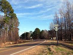
Mississippi Highway 43 generally runs north–south in three segments: the first from U.S. Highway 90 near Bay St. Louis to Mississippi Highway 13 south of Columbia, resuming at MS 13 in southern Jefferson Davis County to end near Mendenhall, and finally starting again at Mississippi Highway 18 near Puckett to end at Attala Road 3122 in northern Attala County. It traverses approximately 235 miles (378 km), serving Hancock, Pearl River, Marion, Jefferson Davis, Lawrence, Simpson, Rankin, Madison, Leake, and Attala counties.
Major intersections
| County | Location | mi | km | Destinations | Notes | ||
|---|---|---|---|---|---|---|---|
| Hancock | Waveland | US 90 / Nicholson Avenue – Bay St. Louis, New Orleans, Buccaneer State Park, Beaches | south end of MS 603 overlap | ||||
| |  I-10 – New Orleans, Mobile I-10 – New Orleans, Mobile | I-10 exit 13 | |||||
| |  MS 603 north MS 603 north | north end of MS 603 overlap | |||||
| Pearl River | Picayune |  I-59 south – Picayune, New Orleans I-59 south – Picayune, New Orleans | south end of I-59 overlap; MS 43 south follows exit 4 | ||||
| I-59 north – Hattiesburg | north end of I-59 overlap; MS 43 north follows exit 6 | ||||||
 US 11 – Picayune, Poplarville US 11 – Picayune, Poplarville | |||||||
| | Beech Street (MS 992 south) | ||||||
| Crossroads |  MS 26 – Bogalusa, Poplarville MS 26 – Bogalusa, Poplarville | ||||||
| Marion | |  MS 13 – Columbia, Lumberton MS 13 – Columbia, Lumberton | |||||
| Gap in route | |||||||
| Jefferson Davis | | MS 13 | |||||
| Lawrence | |  MS 43A north MS 43A north | |||||
| |  MS 184 – Monticello MS 184 – Monticello | ||||||
| Gap in route | |||||||
| Lawrence | Silver Creek | MS 43A south (Front Street) / MS 184 (Southern Avenue) | |||||
| New Hebron | Jones Street (MS 915) | ||||||
 MS 42 – Prentiss MS 42 – Prentiss | |||||||
| Simpson | |  MS 478 west MS 478 west | |||||
| |  MS 28 east – Magee MS 28 east – Magee | south end of MS 28 overlap | |||||
| |  MS 472 west MS 472 west | ||||||
| Pinola | MS 28 west – Hazlehurst | north end of MS 28 overlap | |||||
| Mendenhall | MS 13 – Mendenhall, Jackson, Prentiss | ||||||
| Gap in route | |||||||
| Rankin | Puckett |  MS 18 – Puckett, Brandon, Jackson MS 18 – Puckett, Brandon, Jackson | |||||
| Pelahatchie |  I-20 – Jackson, Meridian I-20 – Jackson, Meridian | I-20 exit 68 | |||||
 US 80 – Brandon, Morton US 80 – Brandon, Morton | |||||||
| |  MS 481 south – Leesburg MS 481 south – Leesburg | ||||||
| Koch |  MS 25 – Jackson, Carthage MS 25 – Jackson, Carthage | interchange | |||||
| |  MS 471 south – Brandon MS 471 south – Brandon | ||||||
| Madison | Madisonville | Natchez Trace | interchange | ||||
| Canton |    MS 16 west (Canton Parkway) to I-55 / US 51 MS 16 west (Canton Parkway) to I-55 / US 51 | south end of MS 16 overlap | |||||
| MS 16 east (East Peace Street) – Downtown Canton, Carthage | north end of MS 16 overlap | ||||||
| |  MS 17 – Camden, Pickens MS 17 – Camden, Pickens | ||||||
| Leake | Thomastown |  MS 429 – Sallis, Carthage MS 429 – Sallis, Carthage | |||||
| Attala | |  MS 14 west – Newport, Goodman MS 14 west – Newport, Goodman | south end of MS 14 overlap | ||||
| | MS 14 east / South Natchez Street – Kosciusko, Louisville | north end of MS 14 overlap | |||||
| |  MS 12 west – Durant MS 12 west – Durant | south end of MS 12 overlap | |||||
| |  MS 735 north MS 735 north | ||||||
| Kosciusko |   MS 19 north / MS 35 north (North Jackson Street) – Vaiden, Kosciusko MS 19 north / MS 35 north (North Jackson Street) – Vaiden, Kosciusko | south end of MS 19 / MS 35 overlap | |||||
| MS 12 east / MS 19 south / MS 35 south – Ackerman | north end of MS 12 / MS 19 / MS 35 overlap | ||||||
| | Winfry Road / County Road 3122 | to MS 407 | |||||
| 1.000 mi = 1.609 km; 1.000 km = 0.621 mi | |||||||
Related routes

| |
|---|---|
| Location: | Picayune |
| Length: | 1.350 mi[1] (2.173 km) |
MS 43 Spur, officially inventoried as Mississippi Highway 992, is a short local road which runs through Picayune, Mississippi. Its northern terminus is at MS 43 and its southern terminus is just north of Goodyear Boulevard in Picayune.
See also
References
- 1 2 "Mississippi Public Roads Selected Statistics" (PDF). Mississippi Department of Transportation. 2008. Retrieved 2010-06-03.